File:Ali Mukhni dan Nasrul Abit Resmikan Surau Rimbo Tolang dan Ponpes Jami’atul Mukminin II.jpg

Size of this preview: 800 × 450 pixels. Other resolutions: 320 × 180 pixels | 640 × 360 pixels | 1,024 × 576 pixels | 1,280 × 720 pixels | 2,560 × 1,440 pixels | 4,128 × 2,322 pixels.
Original file (4,128 × 2,322 pixels, file size: 1.8 MB, MIME type: image/jpeg)
Captions
Captions
Add a one-line explanation of what this file represents
Summary
edit
| Description |
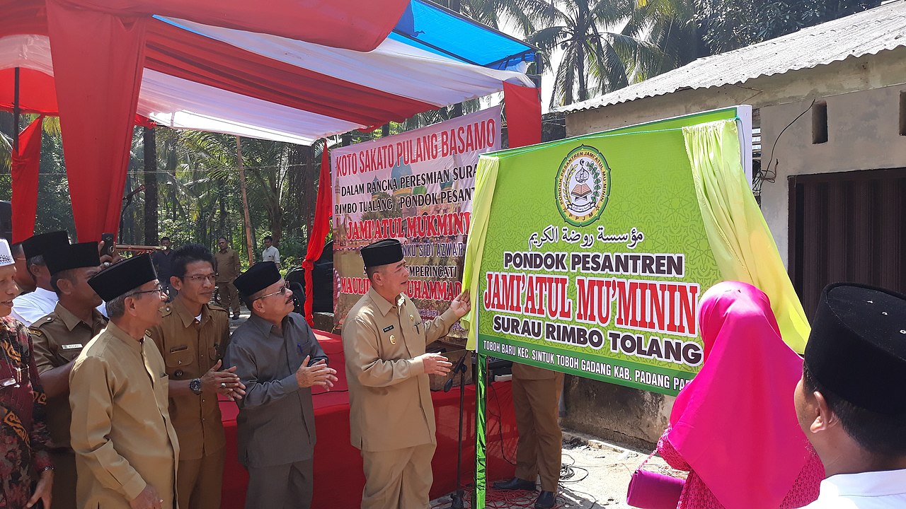
Bahasa Indonesia: Sintuk Toboh Gadang (25/02/2019). Bupati Padang Pariaman Ali Mukhni bersama Wakil Gubernur Sumbar Nasrul Abit meresmikan operasional Surau Rimbo Tolang dan dimulainya pembangunan Pondok Pesantren Jami’atul Mukminin Nagari Toboh Gadang Timur, Kecamatan Sintuk Toboh Gadang, Senin (25/02).
Turut hadir Ketua TP PKK Prov. Sumbar, Nevi Zuairina Irwan Prayitno, Kepala OPD di Lingkungan Pemkab Padang Pariaman, Camat Sintuk Toboh Gadang, Wali Nagari se Kecamatan Sintuk Toboh Gadang dan ratusan masyarakat Nagari Toboh Gadang Timur yang juga jemaah Majelis Taklim Surau Tolang.
English: Sintuk Toboh Gadang (02/25/2019). Padang Pariaman Regent Ali Mukhni together with West Sumatra Deputy Governor Nasrul Abit inaugurated the Surau Rimbo Tolang operation and the construction of the Jami'atul Mukminin Islamic Boarding School Nagari Toboh Gadang Timur, Sintuk Toboh Gadang District, Monday (25/02).
Also present was the Chairman of the TP PKK Prov. West Sumatra, Nevi Zuairina Irwan Prayitno, Head of OPD in the Padang Pariaman District Government, Toboh Gadang Sintuk Sub-District Head, Wali Nagari in Sintuk Toboh Gadang District and hundreds of Nagari Toboh Gadang Timur communities who are also members of the Taklim Surau Tolang Congregation. |
| Date | |
| Source | https://padangpariamankab.go.id/2019/02/26/bupati-ali-mukhni-bersama-wakil-gubernur-sumbar-nasrul-abit-resmikan-surau-rimbo-tualang-dan-pondok-pesantren-jamiatul-mukminin-ii/ |
| Author | Government of Padang Pariaman Regency, Indonesia |
| Camera location | | View this and other nearby images on: OpenStreetMap |
|---|
Licensing
edit
| This file is made available under the Creative Commons CC0 1.0 Universal Public Domain Dedication. | |
| The person who associated a work with this deed has dedicated the work to the public domain by waiving all of their rights to the work worldwide under copyright law, including all related and neighboring rights, to the extent allowed by law. You can copy, modify, distribute and perform the work, even for commercial purposes, all without asking permission.
|
File history
Click on a date/time to view the file as it appeared at that time.
| Date/Time | Thumbnail | Dimensions | User | Comment | |
|---|---|---|---|---|---|
| current | 05:49, 16 January 2020 | | 4,128 × 2,322 (1.8 MB) | Urang Kamang (talk | contribs) | User created page with UploadWizard |
You cannot overwrite this file.
File usage on Commons
There are no pages that use this file.