File:Alpha-E Karte Gustav Richard.jpg
Size of this preview: 800 × 450 pixels. Other resolutions: 320 × 180 pixels | 640 × 360 pixels | 1,280 × 720 pixels.
Original file (1,280 × 720 pixels, file size: 258 KB, MIME type: image/jpeg)
Captions
Captions
Add a one-line explanation of what this file represents
Summary
edit
| Description |
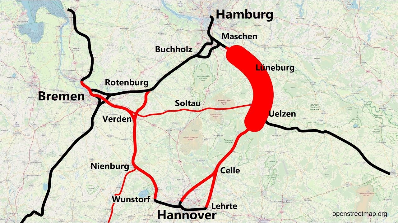
Deutsch: Die Karte zeigt alle Strecken, die im Rahmen des Projekts Optimiertes Alpha-E + Bremen gemäß Bundesverkehrswegeplan 2030 ausgebaut werden, und wo Neubaustrecken möglich bzw. vorgesehen sind. |
| Date | |
| Source | https://www.youtube.com/watch?v=5k3yVDZCT5w |
| Author | Gustav Richard, Karte von OpenStreetMap |
Licensing
edit
This file is licensed under the Creative Commons Attribution 4.0 International license.
- You are free:
- to share – to copy, distribute and transmit the work
- to remix – to adapt the work
- Under the following conditions:
- attribution – You must give appropriate credit, provide a link to the license, and indicate if changes were made. You may do so in any reasonable manner, but not in any way that suggests the licensor endorses you or your use.
File history
Click on a date/time to view the file as it appeared at that time.
| Date/Time | Thumbnail | Dimensions | User | Comment | |
|---|---|---|---|---|---|
| current | 18:50, 2 June 2023 | | 1,280 × 720 (258 KB) | PhiH (talk | contribs) | Uploaded a work by Gustav Richard from https://www.youtube.com/watch?v=5k3yVDZCT5w with UploadWizard |
You cannot overwrite this file.
File usage on Commons
The following 2 pages use this file: