File:Alta Italia.jpg
Size of this preview: 800 × 452 pixels. Other resolutions: 320 × 181 pixels | 640 × 362 pixels | 1,024 × 579 pixels | 1,280 × 723 pixels | 2,501 × 1,413 pixels.
Original file (2,501 × 1,413 pixels, file size: 1.55 MB, MIME type: image/jpeg)
Captions
Captions
Add a one-line explanation of what this file represents
Summary
edit
| Description |
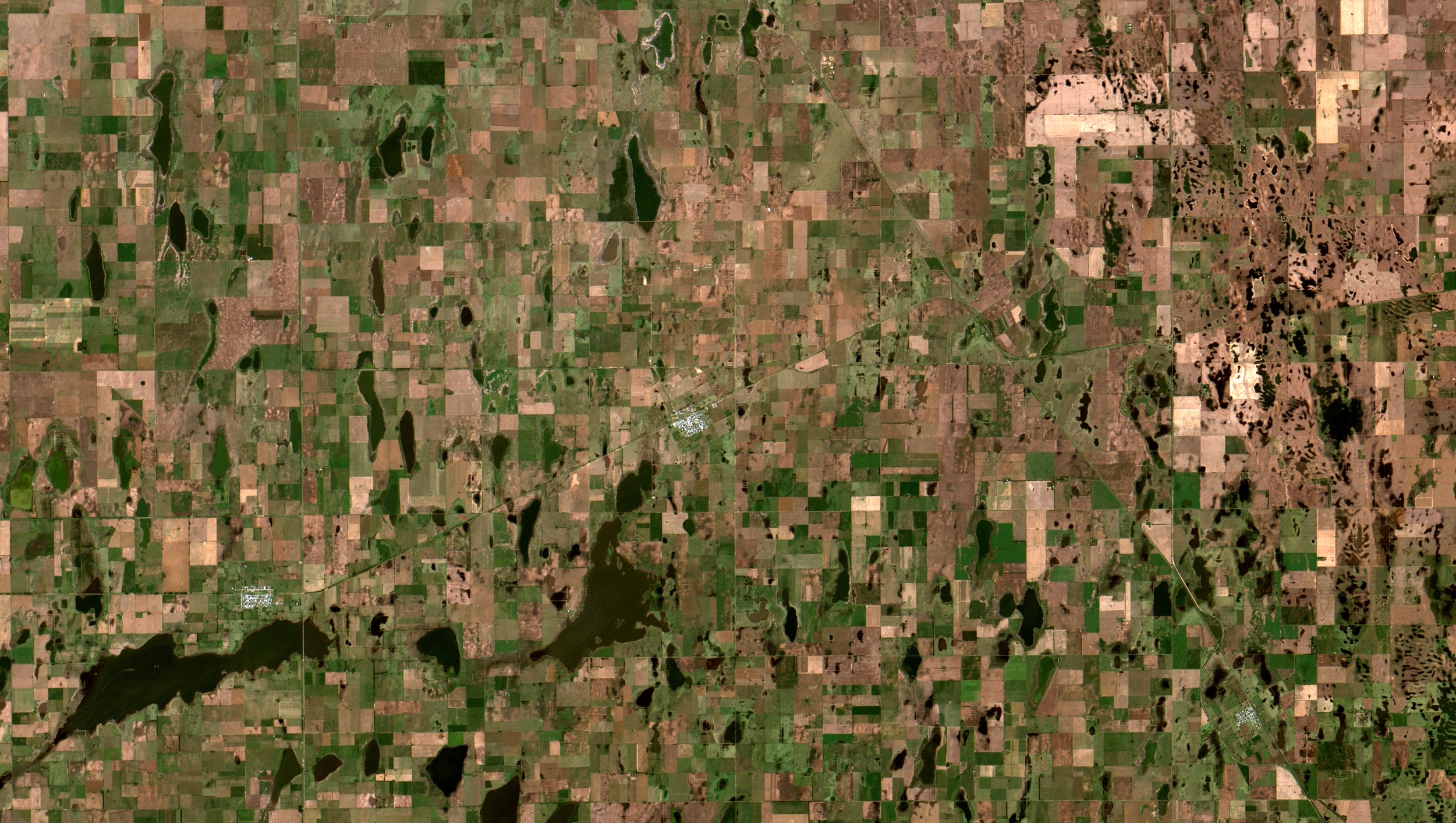
English: Alta Italia, população +1.300, norte da Província de La Pampa, Argentina. Com a colheita do trigo quase terminada e a soja recém plantada, a maioria dos lotes está com solos expostos, em laranja e marrom claro. Em verde provavelmente campos de milho e girassol, as outras culturas agrícolas principais, ou mesmo alfafa e cevada. Vários lagos cheios em marrom escuro e preto. Área urbana de Alta Itália em salpicado branco no centro da imagem / Alta Italia, 1,300+ people, La Pampa Província north, Argentina. With wheat harvest almost finished and soybeans newly sown most plots have exposed soils, in orange and light brown. In green, most probably, maize and sunflower fields, wich are their other main crops, or even alfafa and barley. Several full lakes appear in dark brown and black. Alta Italia town area in saltpepper, at image center.
Imagem / Image CBERS4 MUX Alta Italia Coordenadas do centro da imagem / Image center: 35°20'01.4"S 64°07'08.7"W Data / Date: 18-02-2019 / 2019-18-02 RGB 765 (cor verdadeira / true color) Cena / Scene: 169 / 140 Autor / Author: Oton Barros (DSR/OBT/INPE) Imagem em HD / HD Image Visite-nos / Visit us: www.dsr.inpe.br |
| Date | |
| Source | https://www.flickr.com/photos/153282474@N02/33206742388/ |
| Author | Coordenação-Geral de Observação da Terra/INPE |
Licensing
edit
This file is licensed under the Creative Commons Attribution-Share Alike 2.0 Generic license.
- You are free:
- to share – to copy, distribute and transmit the work
- to remix – to adapt the work
- Under the following conditions:
- attribution – You must give appropriate credit, provide a link to the license, and indicate if changes were made. You may do so in any reasonable manner, but not in any way that suggests the licensor endorses you or your use.
- share alike – If you remix, transform, or build upon the material, you must distribute your contributions under the same or compatible license as the original.
| This image was originally posted to Flickr by Coordenação-Geral de Observação da Terra/INPE at https://flickr.com/photos/153282474@N02/33206742388. It was reviewed on 9 April 2020 by FlickreviewR 2 and was confirmed to be licensed under the terms of the cc-by-sa-2.0. |
File history
Click on a date/time to view the file as it appeared at that time.
| Date/Time | Thumbnail | Dimensions | User | Comment | |
|---|---|---|---|---|---|
| current | 10:13, 9 April 2020 | | 2,501 × 1,413 (1.55 MB) | Jo-Jo Eumerus (talk | contribs) | Uploaded a work by Coordenação-Geral de Observação da Terra/INPE from https://www.flickr.com/photos/153282474@N02/33206742388/ with UploadWizard |
You cannot overwrite this file.
File usage on Commons
The following page uses this file:
- File:Alta Italia (33206742388).jpg (file redirect)
.jpg&redirect=no)