File:Ambush Site, 2006 Lebanon War.png
Size of this preview: 800 × 463 pixels. Other resolutions: 320 × 185 pixels | 640 × 371 pixels | 1,024 × 593 pixels | 1,280 × 741 pixels | 2,994 × 1,734 pixels.
Original file (2,994 × 1,734 pixels, file size: 1.05 MB, MIME type: image/png)
Captions
Captions
Add a one-line explanation of what this file represents
| Description |
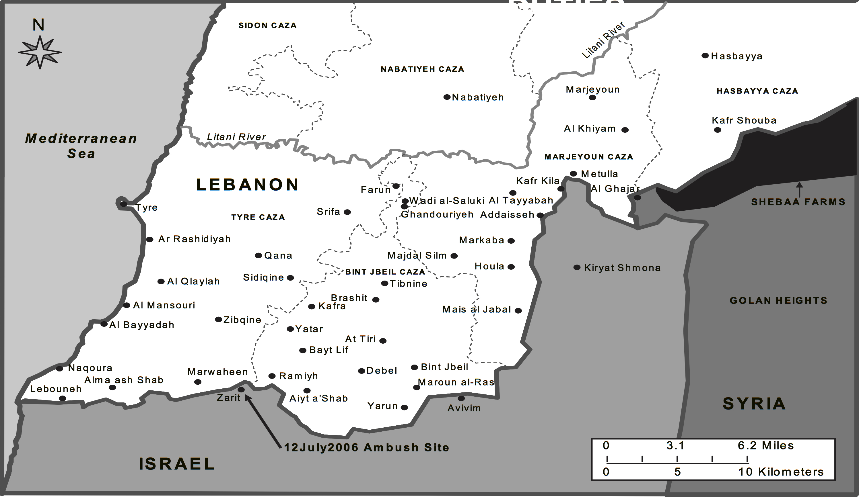
English: Map of southern Lebanon and the ambush site that caused the 2006 Lebanon War. |
|||
| Date | Published June 29, 2012 | |||
| Source | http://usacac.army.mil/CAC2/cgsc/carl/download/csipubs/matthewsOP26.pdf | |||
| Author | Matt M. Matthews | |||
| Permission (Reusing this file) |
|

File history
Click on a date/time to view the file as it appeared at that time.
| Date/Time | Thumbnail | Dimensions | User | Comment | |
|---|---|---|---|---|---|
| current | 07:31, 29 December 2017 | | 2,994 × 1,734 (1.05 MB) | Streamline8988 (talk | contribs) | crop |
| 07:31, 29 December 2017 |  | 3,600 × 2,400 (1.03 MB) | Streamline8988 (talk | contribs) | {{Information |Description ={{en|1=Map of southern Lebanon and the ambush site that caused the 2006 Lebanon War.}} |Source =http://usacac.army.mil/CAC2/cgsc/carl/download/csipubs/matthewsOP26.pdf |Author =Matt M. Matthews |Date... |
You cannot overwrite this file.
File usage on Commons
The following page uses this file: