File:Ampia vista dal drone del borgo di Colognora e dei suoi territori.jpg

Size of this preview: 799 × 600 pixels. Other resolutions: 320 × 240 pixels | 640 × 480 pixels | 1,024 × 768 pixels | 1,286 × 965 pixels.
Original file (1,286 × 965 pixels, file size: 228 KB, MIME type: image/jpeg)
Captions
Captions
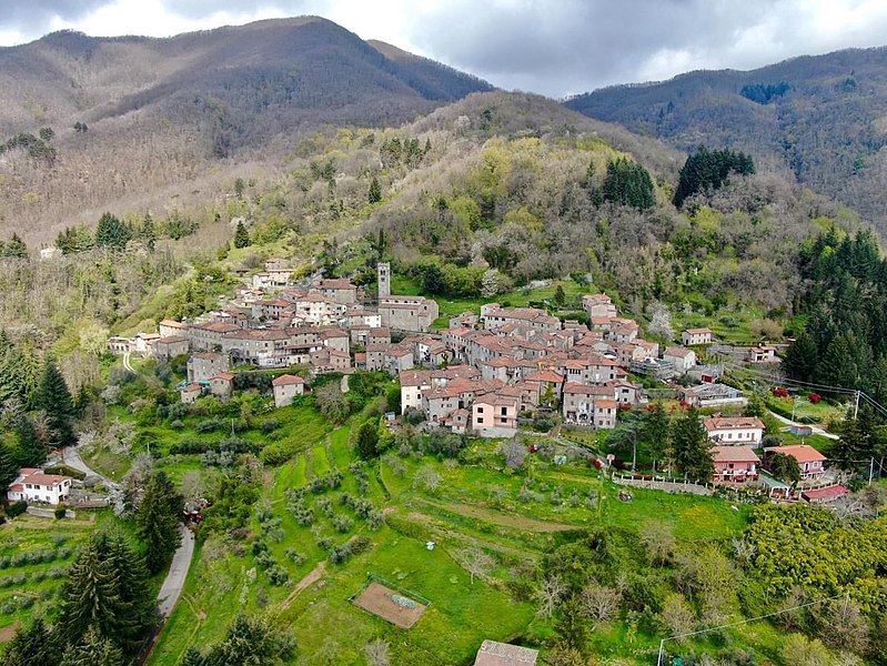
wide view from the drone of Colognora's village and its territories
Summary
edit
| Description |
Italiano: ampia vista dal drone del borgo di Colognora e dei suoi territori
English: wide view from the drone of Colognora's village and its territories |
| Date | |
| Source | copyright: visit.colognora |
| Author | copyright: visit.colognora |
| Camera location | | View this and other nearby images on: OpenStreetMap |
|---|
43°58′57″N 10°27′45″E
Licensing
edit
This file is licensed under the Creative Commons Attribution-Share Alike 4.0 International license.
- You are free:
- to share – to copy, distribute and transmit the work
- to remix – to adapt the work
- Under the following conditions:
- attribution – You must give appropriate credit, provide a link to the license, and indicate if changes were made. You may do so in any reasonable manner, but not in any way that suggests the licensor endorses you or your use.
- share alike – If you remix, transform, or build upon the material, you must distribute your contributions under the same or compatible license as the original.
File history
Click on a date/time to view the file as it appeared at that time.
| Date/Time | Thumbnail | Dimensions | User | Comment | |
|---|---|---|---|---|---|
| current | 01:38, 11 May 2023 | | 1,286 × 965 (228 KB) | Willystw (talk | contribs) | Uploaded a work by copyright: visit.colognora from copyright: visit.colognora with UploadWizard |
You cannot overwrite this file.
File usage on Commons
There are no pages that use this file.