File:Amundsen Gulf.JPG
Size of this preview: 776 × 600 pixels. Other resolutions: 311 × 240 pixels | 621 × 480 pixels | 994 × 768 pixels | 1,280 × 989 pixels | 2,200 × 1,700 pixels.
Original file (2,200 × 1,700 pixels, file size: 528 KB, MIME type: image/jpeg)
Captions
Captions
Add a one-line explanation of what this file represents
Summary
edit
| Description |
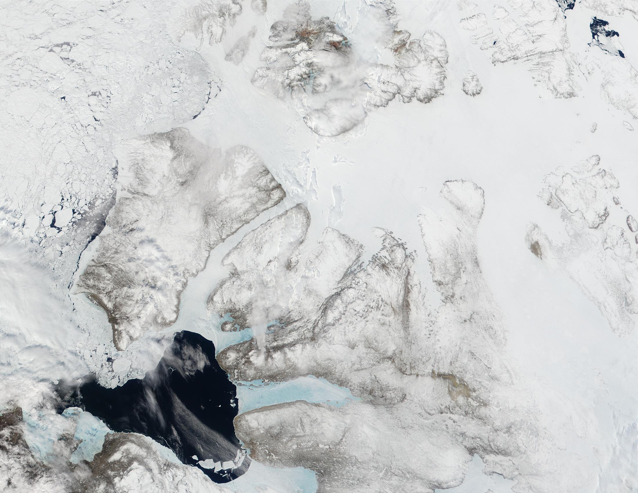
English: Photo from Visible Earth, NASA - Credit Jacques Descloitres, MODIS Land Rapid Response Team.
North of the Northwest Territory, Canada, the Amundsen Gulf separates the mainland from Banks Island (center left) and Victoria Island (center bottom). This MODIS true-color image shows that the Gulf is beginning to break free of its winter ice. |
| Date | |
| Source |
http://visibleearth.nasa.gov/view_rec.php?id=1944
|
| Author | Jacques Descloitres, MODIS Land Rapid Response Team |
Licensing
edit
| This file is in the public domain in the United States because it was solely created by NASA. NASA copyright policy states that "NASA material is not protected by copyright unless noted". (See Template:PD-USGov, NASA copyright policy page or JPL Image Use Policy.) | ||
 |
Warnings:
|
Original upload log
edit
The original description page was here. All following user names refer to en.wikipedia.
- 2005-11-09 21:26 Snowfalcon 2200×1700× (540366 bytes) Photo from Visible Earth, NASA - Credit Jacques Descloitres, MODIS Land Rapid Response Team. North of the Northwest Territory, Canada, the Amundsen Gulf separates the mainland from Banks Island (center left) and Victoria Island (center bottom). This MODI
File history
Click on a date/time to view the file as it appeared at that time.
| Date/Time | Thumbnail | Dimensions | User | Comment | |
|---|---|---|---|---|---|
| current | 22:10, 19 March 2009 | | 2,200 × 1,700 (528 KB) | File Upload Bot (Magnus Manske) (talk | contribs) | {{BotMoveToCommons|en.wikipedia|year={{subst:CURRENTYEAR}}|month={{subst:CURRENTMONTHNAME}}|day={{subst:CURRENTDAY}}}} {{Information |Description={{en|Photo from Visible Earth, NASA - Credit Jacques Descloitres, MODIS Land Rapid Response Team. North of |
You cannot overwrite this file.
File usage on Commons
There are no pages that use this file.