File:Amundsen Map 1 ru.png
Size of this preview: 640 × 600 pixels. Other resolutions: 256 × 240 pixels | 819 × 768 pixels | 1,055 × 989 pixels.
Original file (1,055 × 989 pixels, file size: 622 KB, MIME type: image/png)
Captions
Captions
Add a one-line explanation of what this file represents
Summary edit
| Description |
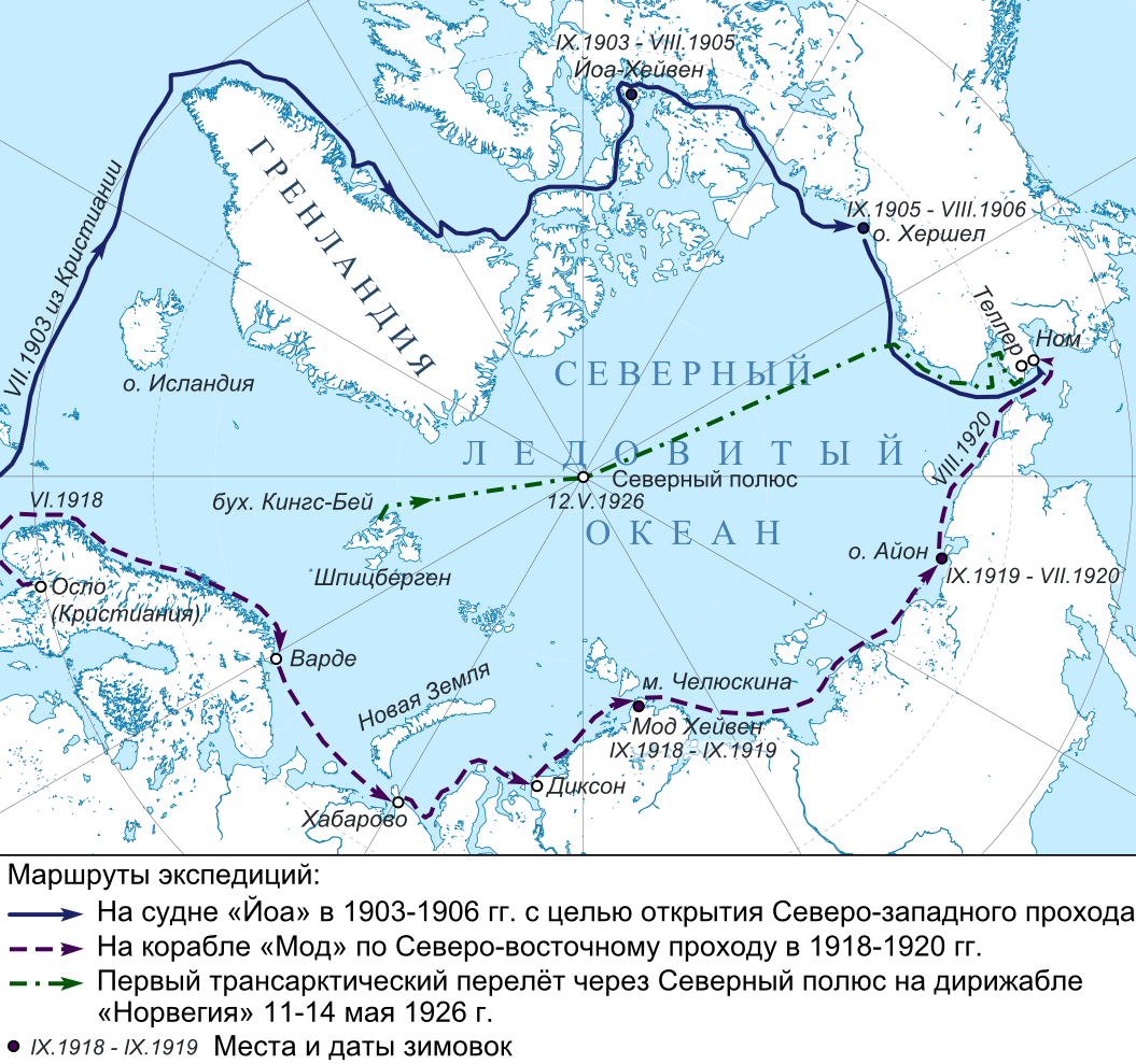
Русский: Карта арктических экспедиций Амундсена.
|
| Date | |
| Source |
|
| Author | Nzeemin |
Licensing edit
I, the copyright holder of this work, hereby publish it under the following license:
This file is licensed under the Creative Commons Attribution-Share Alike 3.0 Unported license.
- You are free:
- to share – to copy, distribute and transmit the work
- to remix – to adapt the work
- Under the following conditions:
- attribution – You must give appropriate credit, provide a link to the license, and indicate if changes were made. You may do so in any reasonable manner, but not in any way that suggests the licensor endorses you or your use.
- share alike – If you remix, transform, or build upon the material, you must distribute your contributions under the same or compatible license as the original.
File history
Click on a date/time to view the file as it appeared at that time.
| Date/Time | Thumbnail | Dimensions | User | Comment | |
|---|---|---|---|---|---|
| current | 06:18, 1 May 2012 | | 1,055 × 989 (622 KB) | Nzeemin (talk | contribs) | plus 2 signs |
| 17:31, 26 April 2012 |  | 1,055 × 989 (610 KB) | Nzeemin (talk | contribs) | done? | |
| 20:47, 25 April 2012 |  | 1,055 × 886 (551 KB) | Nzeemin (talk | contribs) | progress | |
| 18:31, 23 April 2012 |  | 1,085 × 888 (477 KB) | Nzeemin (talk | contribs) | back and points | |
| 18:04, 23 April 2012 |  | 1,085 × 888 (509 KB) | Nzeemin (talk | contribs) |
You cannot overwrite this file.
File usage on Commons
The following page uses this file:
File usage on other wikis
The following other wikis use this file:
- Usage on an.wikipedia.org
- Usage on be.wikipedia.org
- Usage on bg.wikipedia.org
- Usage on bxr.wikipedia.org
- Usage on eo.wikipedia.org
- Usage on fur.wikipedia.org
- Usage on hy.wikipedia.org
- Usage on lad.wikipedia.org
- Usage on lmo.wikipedia.org
- Usage on mk.wikipedia.org
- Usage on ru.wikipedia.org
- Usage on sr.wikipedia.org
- Usage on tt.wikipedia.org