File:AnNamGiang1735-1740-1839.jpg

Size of this preview: 800 × 379 pixels. Other resolutions: 320 × 152 pixels | 640 × 303 pixels | 1,024 × 485 pixels | 1,280 × 606 pixels | 2,280 × 1,080 pixels.
Original file (2,280 × 1,080 pixels, file size: 1.12 MB, MIME type: image/jpeg)
Captions
Captions
Add a one-line explanation of what this file represents
Summary
edit| Description |
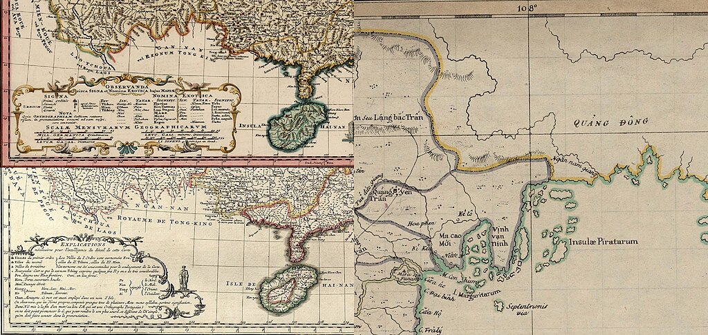
English: A comparison of the Guangxi and Guangdong coastlines in three European maps of the 18th and 19th centuries.
Tiếng Việt: Sông An Nam Giang là biên giới của Việt Nam-Trung Hoa trước năm 1887, trong các bản đồ cổ của người phương Tây những năm 1737, 1740, 1839. |
||||||||||||||||||||
| Date | 1737, 1740, and 1839 | ||||||||||||||||||||
| Source | GDZ Université de Göttingen http://gdz.sub.uni-goettingen.de/de/dms/load/toc/?PPN=PPN340023538 | ||||||||||||||||||||
| Author |
|
||||||||||||||||||||
| Other versions |
|
||||||||||||||||||||


Licensing
edit
|
This is a faithful photographic reproduction of a two-dimensional, public domain work of art. The work of art itself is in the public domain for the following reason:
The official position taken by the Wikimedia Foundation is that "faithful reproductions of two-dimensional public domain works of art are public domain".
This photographic reproduction is therefore also considered to be in the public domain in the United States. In other jurisdictions, re-use of this content may be restricted; see Reuse of PD-Art photographs for details. | ||||
| Annotations | This image is annotated: View the annotations at Commons |
File history
Click on a date/time to view the file as it appeared at that time.
| Date/Time | Thumbnail | Dimensions | User | Comment | |
|---|---|---|---|---|---|
| current | 02:42, 25 January 2017 | | 2,280 × 1,080 (1.12 MB) | Doãn Hiệu (talk | contribs) | {{Thông tin |Miêu tả = Sông An Nam Giang là biên giới của Việt Nam-Trung Hoa trước năm 1887, trong các bản đồ cổ của người phương Tây những năm 1737, 1740, 1839. |Nguồn = https://commons.wikimedia.o… |
You cannot overwrite this file.
File usage on Commons
There are no pages that use this file.
File usage on other wikis
The following other wikis use this file:
- Usage on vi.wikipedia.org
- Usage on zh-yue.wikipedia.org