File:AnacondaAreaOfOperations.jpg
Size of this preview: 800 × 522 pixels. Other resolutions: 320 × 209 pixels | 640 × 417 pixels | 1,024 × 668 pixels | 1,354 × 883 pixels.
Original file (1,354 × 883 pixels, file size: 1.06 MB, MIME type: image/jpeg)
Captions
Captions
Add a one-line explanation of what this file represents
Summary edit
| Description |
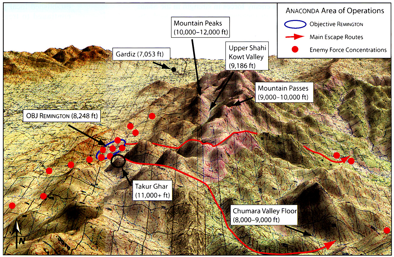
English: Strategic map for U.S. Army operation Anaconda. The area outlined in blue is the Shahi Kowt Valley, about one hundred miles south of Kabul, Afghanistan, near the Pakistani border. |
| Date | |
| Source | U.S. Army brochure the United States Army in Afghanistan |
| Author | U.S. Army |
| Permission (Reusing this file) |
PD-USGOV. |
Licensing edit
This file is a work of a U.S. Army soldier or employee, taken or made as part of that person's official duties. As a work of the U.S. federal government, it is in the public domain in the United States.
|
 |
Original upload log edit
The original description page was here. All following user names refer to en.wikipedia.
- 2007-04-20 23:03 Victor falk 1354×883×8 (1107603 bytes) '''Sourced from:''' http://www.army.mil/cmh/brochures/Afghanistan/Operation%20Enduring%20Freedom.htm
File history
Click on a date/time to view the file as it appeared at that time.
| Date/Time | Thumbnail | Dimensions | User | Comment | |
|---|---|---|---|---|---|
| current | 14:52, 28 April 2008 | | 1,354 × 883 (1.06 MB) | File Upload Bot (Magnus Manske) (talk | contribs) | {{BotMoveToCommons|en.wikipedia}} {{Information |Description={{en|'''Sourced from:''' http://www.army.mil/cmh/brochures/Afghanistan/Operation%20Enduring%20Freedom.htm}} |Source=Transferred from [http://en.wikipedia.org en.wikipedia] |Date=2007-04-20 (ori |
You cannot overwrite this file.
File usage on Commons
The following page uses this file:
File usage on other wikis
The following other wikis use this file:
- Usage on da.wikipedia.org
- Usage on de.wikipedia.org
- Usage on en.wikipedia.org
- Usage on es.wikipedia.org
- Usage on fa.wikipedia.org
- Usage on fi.wikipedia.org
- Usage on uk.wikipedia.org
- Usage on www.wikidata.org
- Usage on zh.wikipedia.org