File:Anglesey track map--Pre-2006.svg

Size of this PNG preview of this SVG file: 800 × 366 pixels. Other resolutions: 320 × 146 pixels | 640 × 293 pixels | 1,024 × 468 pixels | 1,280 × 585 pixels | 2,560 × 1,171 pixels | 1,323 × 605 pixels.
Original file (SVG file, nominally 1,323 × 605 pixels, file size: 26 KB)
Captions
Captions
Add a one-line explanation of what this file represents
Summary
edit
| Description |
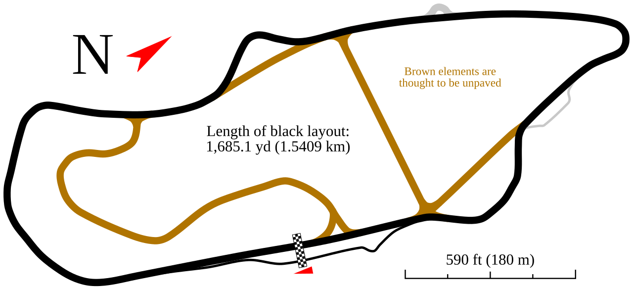
English: Track map for use with Anglesey Circuit |
| Source | Own work |
| Author | Will Pittenger |
This W3C-unspecified vector image was created with Inkscape .
| Camera location | | View this and other nearby images on: OpenStreetMap |
|---|
Licensing
edit
I, the copyright holder of this work, hereby publish it under the following license:
This file is licensed under the Creative Commons Attribution-Share Alike 3.0 Unported license.
- You are free:
- to share – to copy, distribute and transmit the work
- to remix – to adapt the work
- Under the following conditions:
- attribution – You must give appropriate credit, provide a link to the license, and indicate if changes were made. You may do so in any reasonable manner, but not in any way that suggests the licensor endorses you or your use.
- share alike – If you remix, transform, or build upon the material, you must distribute your contributions under the same or compatible license as the original.
File history
Click on a date/time to view the file as it appeared at that time.
| Date/Time | Thumbnail | Dimensions | User | Comment | |
|---|---|---|---|---|---|
| current | 06:52, 8 November 2009 | | 1,323 × 605 (26 KB) | Will Pittenger (talk | contribs) | Oops. Previous version had fills set on objects that should have had them--again. |
| 06:50, 8 November 2009 |  | 1,323 × 605 (26 KB) | Will Pittenger (talk | contribs) | After close examination of the track in Google Earth, I concluded that some parts of the track shown in gray in the original image were unpaved. I changed their color to reflect that. | |
| 20:46, 6 November 2009 |  | 1,323 × 605 (25 KB) | Will Pittenger (talk | contribs) | Still trying to fix that incorrect fill | |
| 20:45, 6 November 2009 |  | 1,323 × 605 (25 KB) | Will Pittenger (talk | contribs) | Previous version had a clone with a fill that wasn't supposed to be filled. This fixes that. | |
| 20:43, 6 November 2009 |  | 1,323 × 605 (25 KB) | Will Pittenger (talk | contribs) | {{Information |Description={{en|1=Track map for use with w:Anglesey Circuit}} |Source={{own}} |Author=Will Pittenger |Date= |Permission= |other_versions= }} {{Inkscape}} {{Location|53|11|27.5|N|4|29|54.3|W}} [[Category:Ang |
You cannot overwrite this file.
File usage on Commons
There are no pages that use this file.
File usage on other wikis
The following other wikis use this file:
- Usage on de.wikipedia.org
- Usage on en.wikipedia.org