File:Anoru, Mueang Pattani District, Pattani 94000, Thailand - panoramio (2).jpg

Size of this preview: 799 × 145 pixels. Other resolutions: 320 × 58 pixels | 640 × 116 pixels | 1,024 × 186 pixels | 1,280 × 233 pixels | 6,605 × 1,200 pixels.
Original file (6,605 × 1,200 pixels, file size: 1.28 MB, MIME type: image/jpeg)
Captions
Captions
Add a one-line explanation of what this file represents
Summary
edit.jpg&action=edit§ion=1)
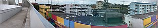
| Description | Anoru, Mueang Pattani District, Pattani 94000, Thailand | ||
| Date | Taken on 24 February 2016 | ||
| Source | https://web.archive.org/web/20161030161137/http://www.panoramio.com/photo/128356826 | ||
| Author | กิตติ เลขะกุล | ||
| Permission (Reusing this file) |
This file is licensed under the Creative Commons Attribution 3.0 Unported license. Attribution: กิตติ เลขะกุล
|
||
| Panoramio Tags | Anoru |
| Camera location | | View this and other nearby images on: OpenStreetMap |
|---|
.jpg¶ms=006.865797_N_0101.253228_E_globe:Earth_type:camera_source:Panoramio_&language=en)
File history
Click on a date/time to view the file as it appeared at that time.
| Date/Time | Thumbnail | Dimensions | User | Comment | |
|---|---|---|---|---|---|
| current | 02:59, 25 June 2017 | 6,605 × 1,200 (1.28 MB) | Panoramio upload bot (talk | contribs) | == {{int:filedesc}} == {{Information |description=Anoru, Mueang Pattani District, Pattani 94000, Thailand |date={{Taken on|2016-02-24}} |source=http://www.panoramio.com/photo/128356826 |author=[http://www.panoramio.com/user/6667993?with_photo_id=128356... |
You cannot overwrite this file.
File usage on Commons
There are no pages that use this file.
.jpg&oldid=796342084)