File:Ansonborough - c. 1800-1820.pdf

Size of this JPG preview of this PDF file: 800 × 513 pixels. Other resolutions: 320 × 205 pixels | 640 × 410 pixels | 1,024 × 656 pixels | 1,280 × 820 pixels | 2,741 × 1,756 pixels.
Original file (2,741 × 1,756 pixels, file size: 4.77 MB, MIME type: application/pdf)
Captions
Captions
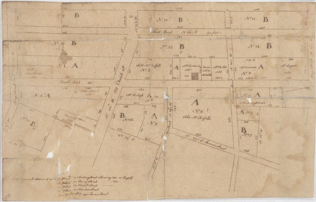
Ansonborough - c. 1800-1820
Summary edit
| Description |
English: Ansonborough - c. 1800-1820 |
| Date | between circa 1800 and circa 1820 |
| Source | Charleston County Deeds Office, McCrady plat 0594 |
| Author | Unknown author |
Licensing edit
This file is licensed under the Creative Commons Attribution-Share Alike 4.0 International license.
- You are free:
- to share – to copy, distribute and transmit the work
- to remix – to adapt the work
- Under the following conditions:
- attribution – You must give appropriate credit, provide a link to the license, and indicate if changes were made. You may do so in any reasonable manner, but not in any way that suggests the licensor endorses you or your use.
- share alike – If you remix, transform, or build upon the material, you must distribute your contributions under the same or compatible license as the original.
File history
Click on a date/time to view the file as it appeared at that time.
| Date/Time | Thumbnail | Dimensions | User | Comment | |
|---|---|---|---|---|---|
| current | 12:49, 15 March 2021 |  | 2,741 × 1,756 (4.77 MB) | ProfReader (talk | contribs) | Uploaded a work by Unknown from Charleston County Deeds Office, McCrady plat 0594 with UploadWizard |
You cannot overwrite this file.
File usage on Commons
There are no pages that use this file.