File:Antarctic sector map 03.jpg
No higher resolution available.
Antarctic_sector_map_03.jpg (500 × 525 pixels, file size: 50 KB, MIME type: image/jpeg)
Captions
Captions
Add a one-line explanation of what this file represents
Summary
edit
| Description |
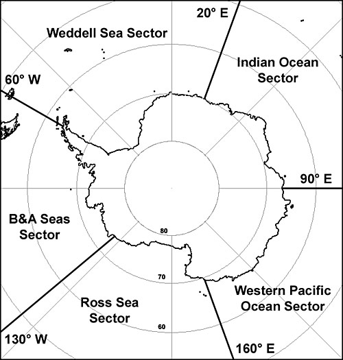
English: Sectors of Antarctica |
| Date | not stated |
| Source | https://neptune.gsfc.nasa.gov/csb/index.php?section=59 |
| Author | NOAA |
Licensing
edit
| This file is in the public domain in the United States because it was solely created by NASA. NASA copyright policy states that "NASA material is not protected by copyright unless noted". (See Template:PD-USGov, NASA copyright policy page or JPL Image Use Policy.) | ||
 |
Warnings:
|
File history
Click on a date/time to view the file as it appeared at that time.
| Date/Time | Thumbnail | Dimensions | User | Comment | |
|---|---|---|---|---|---|
| current | 14:29, 20 April 2017 | | 500 × 525 (50 KB) | Ratzer (talk | contribs) | User created page with UploadWizard |
You cannot overwrite this file.
File usage on Commons
The following page uses this file:
File usage on other wikis
The following other wikis use this file:
- Usage on de.wikipedia.org