File:Antennen Mobilfunk Wlan5GHz Richtfunk.JPG
Size of this preview: 800 × 533 pixels. Other resolutions: 320 × 213 pixels | 640 × 427 pixels | 1,024 × 683 pixels | 1,280 × 853 pixels | 2,816 × 1,877 pixels.
Original file (2,816 × 1,877 pixels, file size: 1.01 MB, MIME type: image/jpeg)
Captions
Captions
Add a one-line explanation of what this file represents
Summary
edit
| Description |
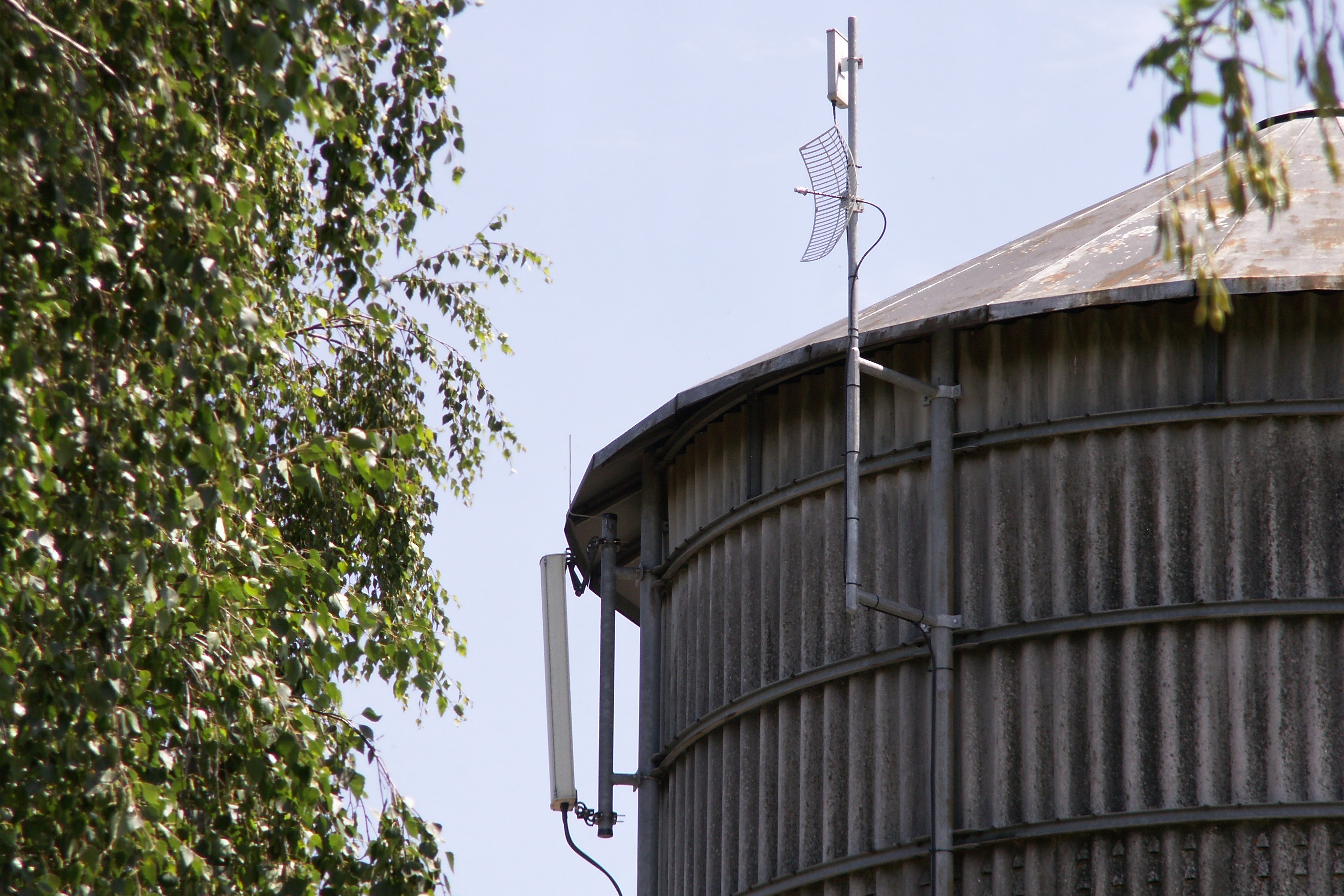
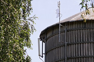
English: Antennas on a Tower. Left one for Cellular Phone, right one (top) a 5 GHz WLAN (Wireless Local Area Network) and a parabolic Antenna. The WLAN is for WEB access in a small Village.
Deutsch: Funkantennen auf einem Blechturm in Höchst/Hassenroth im Odenwald. Links eine Mobilfunkantenne, rechts davon eine Kombination aus (oben) 5 Ghz-WLAN- und Parabolrichtantenne als Relaisstation. Mit der WLAN-Technik ermöglicht ein privater Anbieter die Internetanbindung, da in diesem Dorf DSL teilweise überhaupt nicht oder nur in der langsamsten Variante angeboten wird. Voraussetzung ist freie Sicht zu dieser Anlage, was leider nur für einen Teil der Häuser zutrifft.
Der Turm diente ursprünglich zur Lagerung von Heu. Die Geokoordinaten geben den Standort des Turms an. |
| Date | |
| Source | Own work |
| Author | Mirkotim |
| Camera location | | View this and other nearby images on: OpenStreetMap |
|---|
Licensing
edit
| I, the copyright holder of this work, release this work into the public domain. This applies worldwide. In some countries this may not be legally possible; if so: I grant anyone the right to use this work for any purpose, without any conditions, unless such conditions are required by law. |
File history
Click on a date/time to view the file as it appeared at that time.
| Date/Time | Thumbnail | Dimensions | User | Comment | |
|---|---|---|---|---|---|
| current | 18:35, 23 June 2008 | | 2,816 × 1,877 (1.01 MB) | Mirkotim (talk | contribs) | {{Information |Description={{en|1=Antennas on a Tower. Left one for Cellular Phone, right one (top) a 5 GHz WLAN (Wireless Local Area Network) and a parabolic Antenna. The WLAN is for WEB access in a small Village.}} {{de|1=Funkantennen auf einem Blechtur |
You cannot overwrite this file.
File usage on Commons
There are no pages that use this file.