File:Antietam LOC 2008621644.tif

Size of this JPG preview of this TIF file: 688 × 600 pixels. Other resolutions: 275 × 240 pixels | 551 × 480 pixels | 881 × 768 pixels | 1,174 × 1,024 pixels | 2,349 × 2,048 pixels | 10,805 × 9,422 pixels.
Original file (10,805 × 9,422 pixels, file size: 291.27 MB, MIME type: image/tiff)
Captions
Captions
Add a one-line explanation of what this file represents
Summary edit
| Warning | The original file is very high-resolution. It might not load properly or could cause your browser to freeze when opened at full size. |
|---|
| Description |
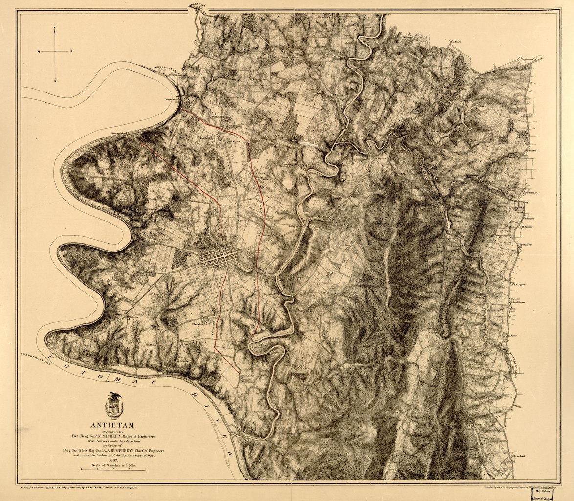
English: Relief shown by hachures. "General direction of Confederate line of battle, Sept. 16th 1862" and "(General direction of) Confederate line of battle, Sept. 17th 1862 (evening)" are hand-colored in red. Union troop positions are not indicated. Detailed map of the environs of Sharpsburg showing roads, the "Washington Co. R.R.," fences, houses, names of residents, vegetation, drainage, villages, the "Burnside Bridge," "Bloody Lane," "Dunker's Chapel," "National Cemetery." Confederate lines of battle are ahnd-colored in red ink. Description derived from published bibliography. LC Civil War Maps (2nd ed.), 245.85 Available also through the Library of Congress web site as raster image. |
||
| Title | Antietam | ||
| Shelf ID | G3844.A68 1867 .M51 | ||
| Date | |||
| Source | https://www.loc.gov/item/2008621644/ | ||
| Author | Michler, N. (Nathaniel); Michler, N. | ||
| Permission (Reusing this file) |
|
||
| Other versions |
|
||
| Location | United States · Maryland · Antietam | ||
| Part of | Military Battles And Campaigns · American Memory · Civil War Maps · Catalog · Geography And Map Division | ||
| Subject | Antietam, Battle Of, Md. · Antietam, Battle Of, Md · United States · Maps · Maryland · Antietam |


Licensing edit
|
This is a faithful photographic reproduction of a two-dimensional, public domain work of art. The work of art itself is in the public domain for the following reason:
The official position taken by the Wikimedia Foundation is that "faithful reproductions of two-dimensional public domain works of art are public domain".
This photographic reproduction is therefore also considered to be in the public domain in the United States. In other jurisdictions, re-use of this content may be restricted; see Reuse of PD-Art photographs for details. | ||||
File history
Click on a date/time to view the file as it appeared at that time.
| Date/Time | Thumbnail | Dimensions | User | Comment | |
|---|---|---|---|---|---|
| current | 23:32, 30 May 2018 |  | 10,805 × 9,422 (291.27 MB) | Fæ (talk | contribs) | LOC Maps https://www.loc.gov/item/2008621644/ #439 |
You cannot overwrite this file.
File usage on Commons
The following page uses this file: