File:Antioch of Pisidia 2906.jpg

Original file (1,600 × 1,065 pixels, file size: 596 KB, MIME type: image/jpeg)
Captions
Captions
Summary
edit
| Description |
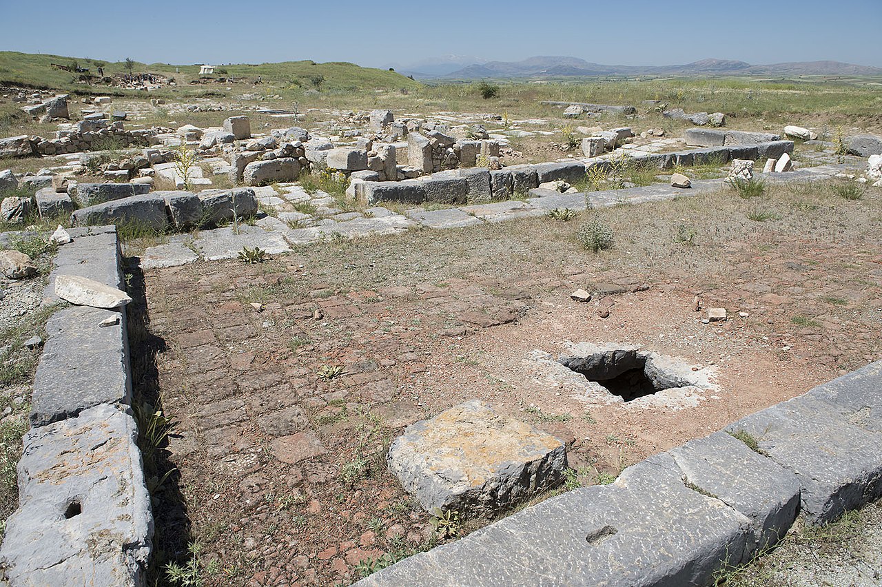
English: Nymphaeum (Fountain): The building is a wide U-shape. It was built to collect water brought by aqueduct and distribute it throughout the city. The building included a reservoir measuring 27 x 3 m, an ornamented 9 m high façade, and a pool of 27 x 7 m and 1,5 m deep. The monumental fountain is dated to the first half of the 1st century AD.
In Pisidia Antiocheia the water, which came from an altitude of 1465m (in the mountains north of the city), was conveyed over a distance of 11 km in channels, through tunnels and on arches of one or two stories, depending of the terrain; the waterway was partly in stone, and partly made of earthenware tubes. As the nymphaeum is at an altitude of 1178m, the drop from the starting point (287 m) gives an average slope of 2,6 %. The water pressure along such a slope is high; so the pressure of flow was lowered by phases, and when the water arrived at the syphon aqueducts at the end of the system, the flow was controlled with a slope of only 0,02 %. As a result of this feat of engineering, 3000 cubic meters of water was distributed to the city daily without any problems for centuries. Correspondent: J.M.Criel, Antwerpen. Sources: ‘Pisidian Antioch’ – Ünal Demirer, archaeologist. (Ankara, 1997) & Personal visits (1994 – 2003). |
| Date | |
| Source | Own work |
| Author | Dosseman |
| Camera location | | View this and other nearby images on: OpenStreetMap |
|---|
Licensing
edit
- You are free:
- to share – to copy, distribute and transmit the work
- to remix – to adapt the work
- Under the following conditions:
- attribution – You must give appropriate credit, provide a link to the license, and indicate if changes were made. You may do so in any reasonable manner, but not in any way that suggests the licensor endorses you or your use.
- share alike – If you remix, transform, or build upon the material, you must distribute your contributions under the same or compatible license as the original.
File history
Click on a date/time to view the file as it appeared at that time.
| Date/Time | Thumbnail | Dimensions | User | Comment | |
|---|---|---|---|---|---|
| current | 20:40, 6 March 2019 | | 1,600 × 1,065 (596 KB) | Dosseman (talk | contribs) | User created page with UploadWizard |
You cannot overwrite this file.
File usage on Commons
There are no pages that use this file.
File usage on other wikis
The following other wikis use this file:
- Usage on en.wikipedia.org