File:AntrimShape.png
No higher resolution available.
AntrimShape.png (532 × 405 pixels, file size: 11 KB, MIME type: image/png)
Captions
Captions
Add a one-line explanation of what this file represents
Summary edit
| Description |
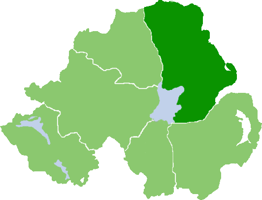
English: Outline map of County Antrim, Northern Ireland |
| Date | |
| Source | Own work (Original text: own work, based on :Image:NIShape.gif) |
| Author | User:Grutness, based on work of User:Setanta747 / Grutness at English Wikipedia |
Licensing edit
| This work has been released into the public domain by its author, Grutness at English Wikipedia. This applies worldwide. In some countries this may not be legally possible; if so: Grutness grants anyone the right to use this work for any purpose, without any conditions, unless such conditions are required by law. |
Original upload log edit
Transferred from en.wikipedia to Commons by Quadell using CommonsHelper.
The original description page was here. All following user names refer to en.wikipedia.
- 2008-07-07 07:55 Grutness 532×405× (10561 bytes) {{Information |Description=Outline map of County Antrim, Northern Ireland |Source=own work, based on NIShape.gif |Date=7/7/08 |Author=[[User:Grutness]], based on work of [[User:Mal]] |Permission=PD-self |other_versions= }}
Original upload log edit
| Date/Time | Dimensions | User | Comment |
|---|---|---|---|
| 25 July 2013, 15:29:41 | 532 × 405 (10561 bytes) | File Upload Bot (Magnus Manske) (talk · contribs) | Transfered from en.wikipedia by [[User:Quadell]] using CommonsHelper |
File history
Click on a date/time to view the file as it appeared at that time.
| Date/Time | Thumbnail | Dimensions | User | Comment | |
|---|---|---|---|---|---|
| current | 23:17, 16 August 2014 | | 532 × 405 (11 KB) | GifTagger (talk | contribs) | Bot: Converting file to superior PNG file. (Source: AntrimShape.gif). This GIF was problematic due to transparency and non-greyscale color table. |
You cannot overwrite this file.
File usage on Commons
The following page uses this file:
- File:AntrimShape.gif (file redirect)
File usage on other wikis
The following other wikis use this file:
- Usage on en.wikipedia.org
- Dunseverick
- Lagan Valley
- Benbane Head
- Aldergrove, County Antrim
- Donegore
- Tobergill
- Parkgate, County Antrim
- Dunadry
- Lisnagarvey
- Stranocum
- Glenariff
- Monkstown, County Antrim
- Barmeen
- A36 road (Northern Ireland)
- Groggan
- Killead
- Grange Corner
- Bendooragh
- Glenoe
- Mill Bay, County Antrim
- Mounthill
- Mullaghboy
- Dundrod
- Halfpenny Gate
- Keshbridge
- Longkesh
- Lower Ballinderry
- Lower Broomhedge
- Lurganure
- Tullynacross
- Ballyvoy
- Moss-side, County Antrim
- Ballyeaston
- Craigarogan
- Millbank, County Antrim
- Roughfort
- Glendun
- Wallace Park
- Glenariff Forest Park
- Gawley's Gate
- Portmore Lough
- Aughafatten
- The People's Park, Ballymena
- Kellswater
- Derrymore, County Antrim
- Capecastle
- Buckna
- Ballylinney
- Carnalbanagh
- Drains Bay
View more global usage of this file.