File:Appalachian map de.svg

Size of this PNG preview of this SVG file: 402 × 556 pixels. Other resolutions: 173 × 240 pixels | 347 × 480 pixels | 555 × 768 pixels | 740 × 1,024 pixels | 1,481 × 2,048 pixels.
Original file (SVG file, nominally 402 × 556 pixels, file size: 49 KB)
Captions
Captions
Add a one-line explanation of what this file represents
| Description |
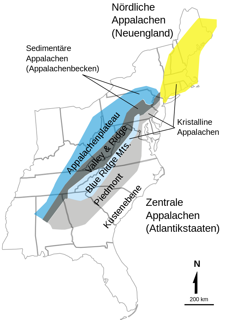
Deutsch: Zonierung der Appalachen gemäß USGS
English: USGS Appalachian zones in the United States |
| Date | |
| Source | see other version below, originally from http://3dparks.wr.usgs.gov/nyc/images/fig51.jpg, see also http://3dparks.wr.usgs.gov/nyc/common/captions.htm |
| Author | USGS, svg version by Jo |
| Other versions | Appalachian map.jpg |
This image is in the public domain in the United States because it only contains materials that originally came from the United States Geological Survey, an agency of the United States Department of the Interior. For more information, see the official USGS copyright policy.
|
| This work has been released into the public domain by its author, Jo Weber. This applies worldwide. In some countries this may not be legally possible; if so: |
File history
Click on a date/time to view the file as it appeared at that time.
| Date/Time | Thumbnail | Dimensions | User | Comment | |
|---|---|---|---|---|---|
| current | 22:39, 21 March 2009 | | 402 × 556 (49 KB) | Jo Weber (talk | contribs) | {{Information |Description= {{de|Zonierung der Appalachen gemäß USGS}} {{en|USGS Appalachian zones in the United States}} |Source=see other version below, orignally from http://3dparks.wr.usgs.gov/nyc/images/fig51.jpg, see also http://3dparks.wr.usgs.go |
You cannot overwrite this file.
File usage on Commons
There are no pages that use this file.
File usage on other wikis
The following other wikis use this file:
- Usage on de.wikipedia.org