File:Apra Harbor and Polaris Point in 1945 (cropped).jpg
Size of this preview: 743 × 600 pixels. Other resolutions: 297 × 240 pixels | 595 × 480 pixels | 951 × 768 pixels | 1,189 × 960 pixels.
Original file (1,189 × 960 pixels, file size: 231 KB, MIME type: image/jpeg)
Captions
Captions
Add a one-line explanation of what this file represents
Summary edit
| Description |
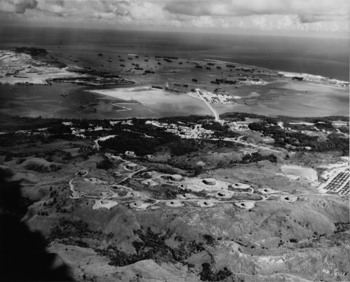
English: Title: Apra Harbor, Guam Caption: View of the U.S. Naval Base in Apra Harbor in 1945. In the foreground is the fuel depot, with the tanker unloading causeway beyond it. The Orote Peninsula is on the left, and Cabras Island is on the right. |
| Date | |
| Source | https://www.history.navy.mil/our-collections/photography/numerical-list-of-images/nhhc-series/nh-series/80-G-701000/80-G-701268.html |
| Author | U.S. National Archives |
| Other versions |
|


.jpg&action=edit§ion=1)
Licensing edit
.jpg&action=edit§ion=2)
This file is a work of a sailor or employee of the U.S. Navy, taken or made as part of that person's official duties. As a work of the U.S. federal government, it is in the public domain in the United States.
|
 | |
| This file has been identified as being free of known restrictions under copyright law, including all related and neighboring rights. | ||
File history
Click on a date/time to view the file as it appeared at that time.
| Date/Time | Thumbnail | Dimensions | User | Comment | |
|---|---|---|---|---|---|
| current | 17:24, 4 April 2021 | | 1,189 × 960 (231 KB) | Featous (talk | contribs) | File:Apra Harbor and Polaris Point in 1945.jpg cropped 7 % horizontally, 8 % vertically using CropTool with lossless mode. |
You cannot overwrite this file.
File usage on Commons
The following page uses this file:
.jpg&oldid=840752937)