File:April 12 2011 Fukushima earthquake shake map.jpg

Size of this preview: 511 × 600 pixels. Other resolutions: 204 × 240 pixels | 612 × 718 pixels.
Original file (612 × 718 pixels, file size: 107 KB, MIME type: image/jpeg)
Captions
Captions
Add a one-line explanation of what this file represents
Summary
edit
| Description |
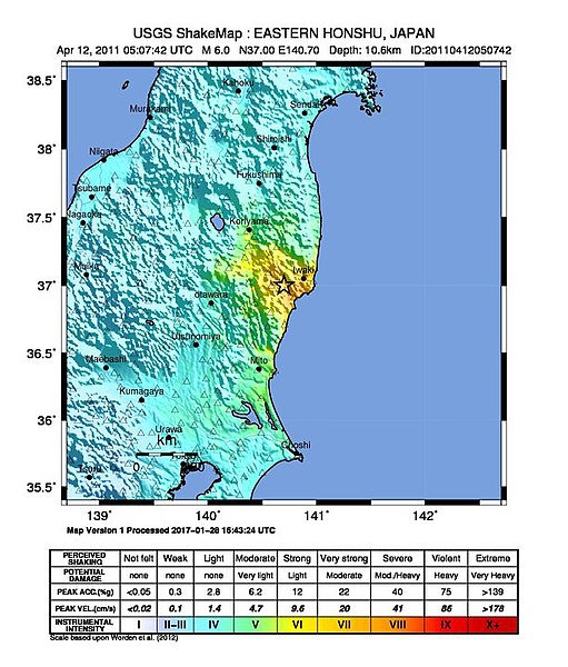
한국어: 2011년 4월 12일 일어난 일본 후쿠시마현 나카도리 지진의 지역별 진도 지도. |
| Date | |
| Source | https://earthquake.usgs.gov/earthquakes/eventpage/usp000hzt4/shakemap/intensity |
| Author | USGS |
Licensing
edit
This image is in the public domain in the United States because it only contains materials that originally came from the United States Geological Survey, an agency of the United States Department of the Interior. For more information, see the official USGS copyright policy.
|
File history
Click on a date/time to view the file as it appeared at that time.
| Date/Time | Thumbnail | Dimensions | User | Comment | |
|---|---|---|---|---|---|
| current | 01:41, 15 January 2019 | | 612 × 718 (107 KB) | Twotwo2019 (talk | contribs) | User created page with UploadWizard |
You cannot overwrite this file.
File usage on Commons
There are no pages that use this file.
File usage on other wikis
The following other wikis use this file:
- Usage on ko.wikipedia.org