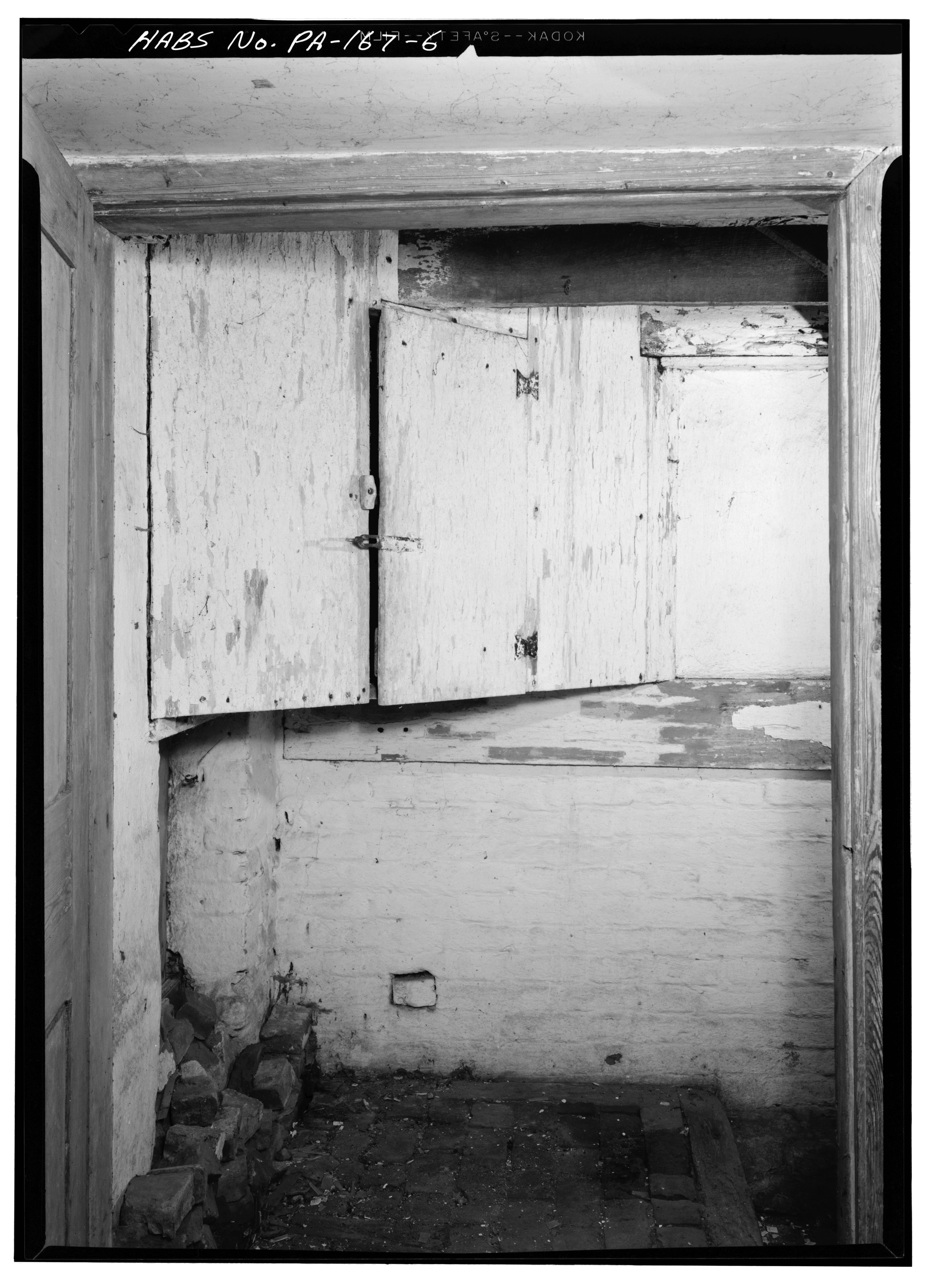
File:April 14, 1960 FIRST FLOOR, CORNER CUPBOARD IN STAIR LANDING TO CELLAR - Primitive Hall, State Route 841 (West Marlborough Township), Clonmell, Chester County, PA HABS PA,15-CLON.V,1-6.tif

Size of this JPG preview of this TIF file: 434 × 599 pixels. Other resolutions: 174 × 240 pixels | 347 × 480 pixels | 556 × 768 pixels | 741 × 1,024 pixels | 1,483 × 2,048 pixels | 3,621 × 5,000 pixels.
Original file (3,621 × 5,000 pixels, file size: 17.27 MB, MIME type: image/tiff)
Captions
Captions
Add a one-line explanation of what this file represents
Summary edit
| April 14, 1960 FIRST FLOOR, CORNER CUPBOARD IN STAIR LANDING TO CELLAR - Primitive Hall, State Route 841 (West Marlborough Township), Clonmell, Chester County, PA | ||||
|---|---|---|---|---|
| Photographer |
Related names:
|
|||
| Title |
April 14, 1960 FIRST FLOOR, CORNER CUPBOARD IN STAIR LANDING TO CELLAR - Primitive Hall, State Route 841 (West Marlborough Township), Clonmell, Chester County, PA |
|||
| Depicted place | Pennsylvania; Chester County; Clonmell | |||
| Date | Documentation compiled after 1933 | |||
| Dimensions | 5 x 7 in. | |||
| Current location |
Library of Congress Prints and Photographs Division Washington, D.C. 20540 USA http://hdl.loc.gov/loc.pnp/pp.print |
|||
| Accession number |
HABS PA,15-CLON.V,1-6 |
|||
| Credit line |
|
|||
| Notes |
|
|||
| References |
|
|||
| Source | https://www.loc.gov/pictures/item/pa0257.photos.131928p | |||
| Permission (Reusing this file) |
|
|||

| Object location | | View this and other nearby images on: OpenStreetMap |
|---|
File history
Click on a date/time to view the file as it appeared at that time.
| Date/Time | Thumbnail | Dimensions | User | Comment | |
|---|---|---|---|---|---|
| current | 16:50, 2 August 2014 |  | 3,621 × 5,000 (17.27 MB) | Fæ (talk | contribs) | GWToolset: Creating mediafile for Fæ. HABS 2014-08-01 2601-2900 missing |
You cannot overwrite this file.
File usage on Commons
The following page uses this file: