File:Arctic search and rescue agreement - areas of application - illustrative map.gif
Size of this preview: 764 × 600 pixels. Other resolutions: 306 × 240 pixels | 612 × 480 pixels.
Original file (800 × 628 pixels, file size: 208 KB, MIME type: image/gif)
Captions
Captions
Add a one-line explanation of what this file represents
Summary edit
| Description |
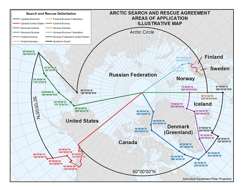
English: Map illustrating the areas of search and rescue assigned to each coastal country in the Arctic. The map illustrates the decisions reached in the treaty Agreement on Cooperation on Aeronautical and Maritime Search and Rescue in the Arctic, under the auspices of the Arctic Council. It was signed May 12, 2011 in the Arctic Council Nuuk Ministerial Meeting. |
| Date | |
| Source | Norwegian Ministry of Foreign Affairs |
| Author | Unknown author |
Licensing edit
| This file is in the public domain because legal statutes, administrative regulations, court decisions and other decisions by public authorities are unprotected. This is also the case with proposals, reports and other statements which concern the public exercise of authority, and which are made by a public authority, a publicly appointed council or committee, or published by the public authorities. Similarly, official translations of such texts are unprotected. Intellectual works ("åndsverk" as defined in § 2) which have not been produced specially for use in documents specified in the first paragraph, and from which parts are quoted or which are reproduced in a separate appendix, are not covered by this provision. The same apply to poetry, musical compositions or works of art.
|
 |
File history
Click on a date/time to view the file as it appeared at that time.
| Date/Time | Thumbnail | Dimensions | User | Comment | |
|---|---|---|---|---|---|
| current | 15:31, 19 October 2014 | | 800 × 628 (208 KB) | Al83tito (talk | contribs) | User created page with UploadWizard |
You cannot overwrite this file.
File usage on Commons
There are no pages that use this file.
File usage on other wikis
The following other wikis use this file:
- Usage on en.wikipedia.org
- Usage on ja.wikipedia.org
- Usage on ru.wikipedia.org
- Usage on sv.wikipedia.org
- Usage on uz.wikipedia.org
- Usage on www.wikidata.org