File:Areines (Loir-et-Cher) (15012656074).jpg
Original file (4,928 × 3,264 pixels, file size: 5.87 MB, MIME type: image/jpeg)
Captions
Captions
Summary edit
_(15012656074).jpg&action=edit§ion=1)
| Description |
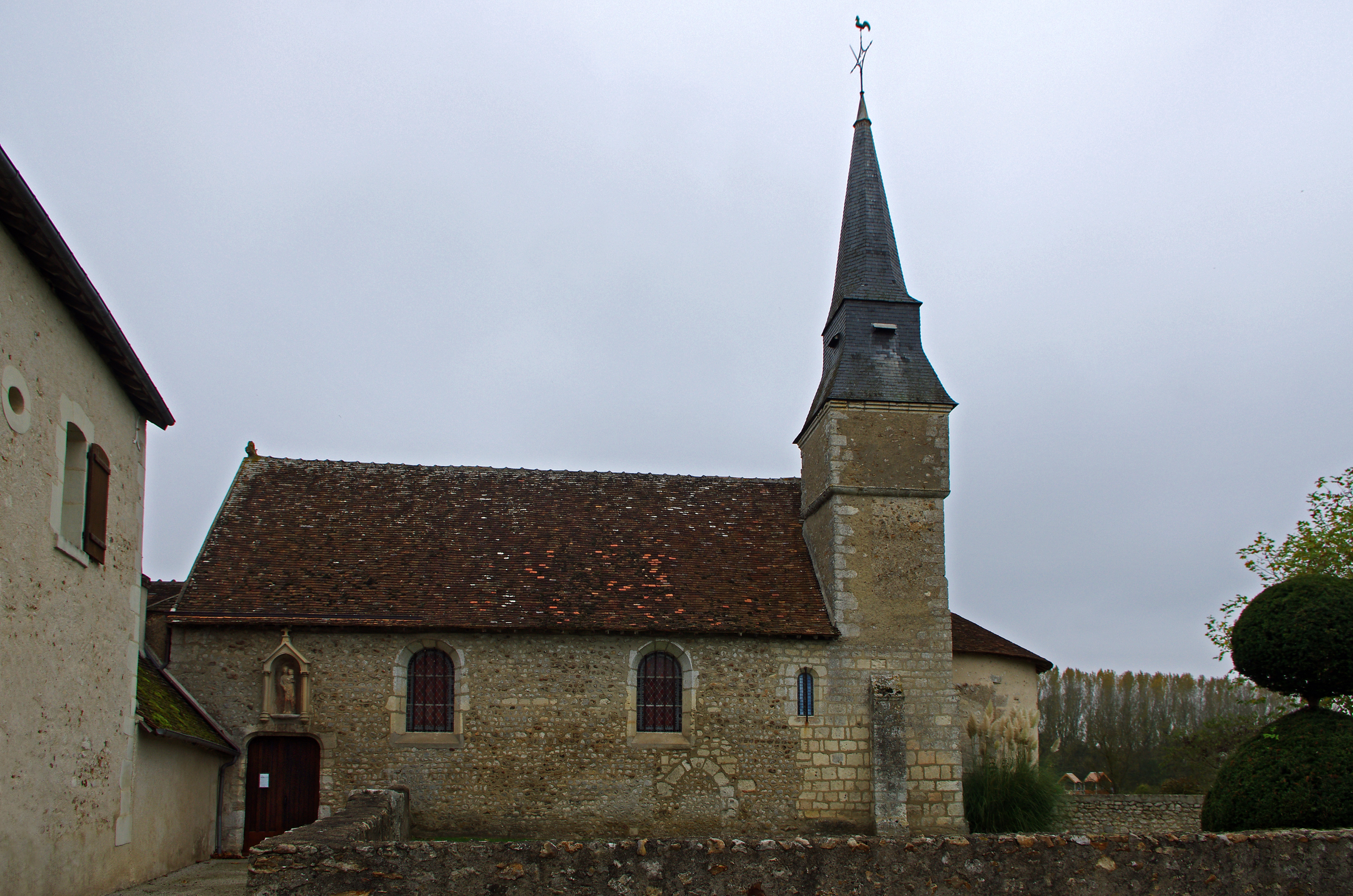
Areines (Loir-et-Cher) Eglise Notre-Dame. L'édifice est daté de la fin du XIème siècle. L'abside à été reprise au XIIème siècle et le clocher ajouté. Le clocher sera terminé au XVème siècle. Un pouillé* chartrain du XIIIème siècle signale que le terrain de l'église et une partie du bourg appartiennent au monastère de la Virginité (monastère fondé en 1220, près de Montoire). La cure est mentionnée parmi les bénéfices du chapitre de Chartres. (Bulletin de la Société archéologique, scientifique et littéraire du Vendômois. 1936-S. Trocmé) Au XVème siècle on condamne l'ancienne entrée et on ouvre l'entrée actuelle sur la façade sud. Probablement vers la même période, on ouvre deux grande fenêtres dans la nef. Une porte, dite "porte des morts", a été obstruée, sans doute parce que le sol du cimetière s'est trouvé surélevé. Au dessus du portail d'entrée, une niche abrite une Vierge à l'enfant du XVème siècle.
Church of Our Lady. The building dates from the late eleventh century. The apse has been changed in the twelfth century and the bell tower added. The tower will be completed in the fifteenth century. A registry of Chartres, of the thirteenth century, said that the grounds of the church and part of the town are the property of the monastery of Virginity (monastery founded in 1220, near Montoire). The cure is mentioned among the benefits of religious chapter of Chartres. (Bulletin of the Archaeological Society, scientific and literary Vendômois. 1936-S. Trocmé) In the fifteenth century we condemn the ancient entrance and opening the current entrance on the south façade. Probably around the same time, it opens two large windows in the nave. A door called "Door of the Dead" was obstructed probably because the ground of the cemetery was found elevated. Above the entrance gate, a niche houses a Madonna and Child of the fifteenth century. |
| Date | Taken on 25 October 2014, 14:34 |
| Source | Areines (Loir-et-Cher) |
| Author | Daniel Jolivet |
| Camera location | | View this and other nearby images on: OpenStreetMap |
|---|
_(15012656074).jpg¶ms=047.801838_N_0001.093561_E_globe:Earth_type:camera_source:Flickr_&language=en)
Licensing edit
_(15012656074).jpg&action=edit§ion=2)
- You are free:
- to share – to copy, distribute and transmit the work
- to remix – to adapt the work
- Under the following conditions:
- attribution – You must give appropriate credit, provide a link to the license, and indicate if changes were made. You may do so in any reasonable manner, but not in any way that suggests the licensor endorses you or your use.
| This image was originally posted to Flickr by sybarite48 at https://flickr.com/photos/26082117@N07/15012656074 (archive). It was reviewed on 14 November 2017 by FlickreviewR 2 and was confirmed to be licensed under the terms of the cc-by-2.0. |
File history
Click on a date/time to view the file as it appeared at that time.
| Date/Time | Thumbnail | Dimensions | User | Comment | |
|---|---|---|---|---|---|
| current | 16:20, 14 November 2017 | | 4,928 × 3,264 (5.87 MB) | Thesupermat2 (talk | contribs) | Transferred from Flickr via Flickr2Commons |
You cannot overwrite this file.
File usage on Commons
There are no pages that use this file.
File usage on other wikis
The following other wikis use this file:
- Usage on fr.wikipedia.org
_(15012656074).jpg&oldid=801164079)