File:Argentina San Juan topographic location map.png
Size of this preview: 508 × 599 pixels. Other resolutions: 203 × 240 pixels | 407 × 480 pixels | 650 × 767 pixels.
Original file (650 × 767 pixels, file size: 143 KB, MIME type: image/png)
Captions
Captions
Add a one-line explanation of what this file represents
Summary
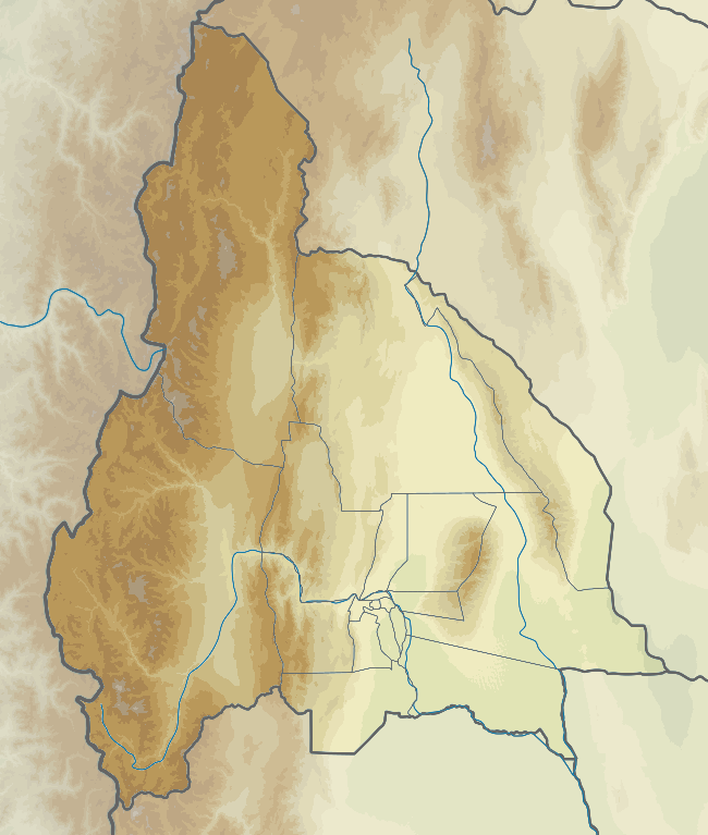
edit| Description |
English: Topographic location map of San Juan province (Argentina).
Español: Mapa topográfico de localización en la provincia de San Juan (Argentina).
Equirectangular projection, N/S stretching 115 %. Geographic limits of the map:
|
| Date | |
| Source | Own work based on: Argentina San Juan location map.svg, elevation data: GEBCO 2022 |
| Author | GrandEscogriffe, Milenioscuro |
| Other versions |
|

Licensing
edit
I, the copyright holder of this work, hereby publish it under the following license:
This file is licensed under the Creative Commons Attribution-Share Alike 4.0 International license.
- You are free:
- to share – to copy, distribute and transmit the work
- to remix – to adapt the work
- Under the following conditions:
- attribution – You must give appropriate credit, provide a link to the license, and indicate if changes were made. You may do so in any reasonable manner, but not in any way that suggests the licensor endorses you or your use.
- share alike – If you remix, transform, or build upon the material, you must distribute your contributions under the same or compatible license as the original.
File history
Click on a date/time to view the file as it appeared at that time.
| Date/Time | Thumbnail | Dimensions | User | Comment | |
|---|---|---|---|---|---|
| current | 15:05, 27 December 2022 | | 650 × 767 (143 KB) | GrandEscogriffe (talk | contribs) | Uploaded own work with UploadWizard |
You cannot overwrite this file.
File usage on Commons
The following page uses this file:
File usage on other wikis
The following other wikis use this file:
- Usage on es.wikipedia.org
- Usage on fr.wikipedia.org
- San Juan (Argentine)
- San José de Jáchal
- Mercedario
- Villa General San Martín
- El Salvador (San Juan)
- Tamberías
- Caucete
- Villa Paula Albarracín de Sarmiento
- Rodeo (San Juan)
- Nueve de Julio (San Juan)
- Villa Aberastain
- Villa Krause
- Rivadavia (San Juan)
- Villa San Martín (San Juan)
- Santa Lucía (San Juan)
- Media Agua
- Angualasto
- Villa Ibáñez
- Villa San Agustín
- Villa Santa Rosa
- Villa Basilio Nievas
- Iglesia (San Juan)
- Calingasta
- Las Flores (San Juan)
- Pismanta
- Huaco (San Juan)
- Modèle:Géolocalisation/San Juan
- Usage on he.wikipedia.org