File:Argyre basin topo.jpg

Size of this preview: 571 × 600 pixels. Other resolutions: 228 × 240 pixels | 457 × 480 pixels | 731 × 768 pixels | 1,024 × 1,076 pixels.
Original file (1,024 × 1,076 pixels, file size: 772 KB, MIME type: image/jpeg)
Captions
Captions
Add a one-line explanation of what this file represents

Summary
edit
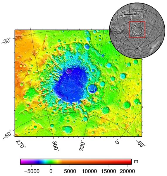
| Description | Argyre basin (Mars) topography |
| Date | 9 October 2006 (upload date) |
| Source | plotted using GMT and gridded MOLA data archive meg0031t.grd |
| Author | Martin Pauer (Power) |
| Permission (Reusing this file) |
PD |
Licensing
edit
| I, the copyright holder of this work, release this work into the public domain. This applies worldwide. In some countries this may not be legally possible; if so: I grant anyone the right to use this work for any purpose, without any conditions, unless such conditions are required by law. |
File history
Click on a date/time to view the file as it appeared at that time.
| Date/Time | Thumbnail | Dimensions | User | Comment | |
|---|---|---|---|---|---|
| current | 19:09, 9 October 2006 | | 1,024 × 1,076 (772 KB) | Power (talk | contribs) | == Popis == {{Information |Description=Argyre basin (Mars) topography |Source=plotted using GMT and gridded MOLA data archive meg0031t.grd |Date=9.10.2006 |Author=Martin Pauer (Power) |Permission=PD }} |
You cannot overwrite this file.
File usage on Commons
The following page uses this file:
File usage on other wikis
The following other wikis use this file:
- Usage on af.wikipedia.org
- Usage on ca.wikipedia.org
- Usage on cs.wikipedia.org
- Usage on de.wikipedia.org
- Usage on el.wikipedia.org
- Usage on en.wikipedia.org
- Usage on es.wikipedia.org
- Usage on fi.wikipedia.org
- Usage on gl.wikipedia.org
- Usage on ml.wikipedia.org
- Usage on pl.wikipedia.org
- Usage on pnb.wikipedia.org
- Usage on pt.wikipedia.org
- Usage on ro.wikipedia.org
- Usage on sk.wikipedia.org
- Usage on uk.wikipedia.org
- Usage on ur.wikipedia.org
- Usage on zh.wikipedia.org