File:Aristide-Michel Perrot, Nouveau plan de Paris divisé en arrondissements, quartiers et paroisses, 1867 - BHVP.jpg

Size of this preview: 800 × 594 pixels. Other resolutions: 320 × 238 pixels | 640 × 475 pixels | 1,024 × 760 pixels | 1,280 × 950 pixels | 2,560 × 1,901 pixels | 6,261 × 4,649 pixels.
Original file (6,261 × 4,649 pixels, file size: 7.02 MB, MIME type: image/jpeg)
Captions
Captions
Add a one-line explanation of what this file represents
Summary edit
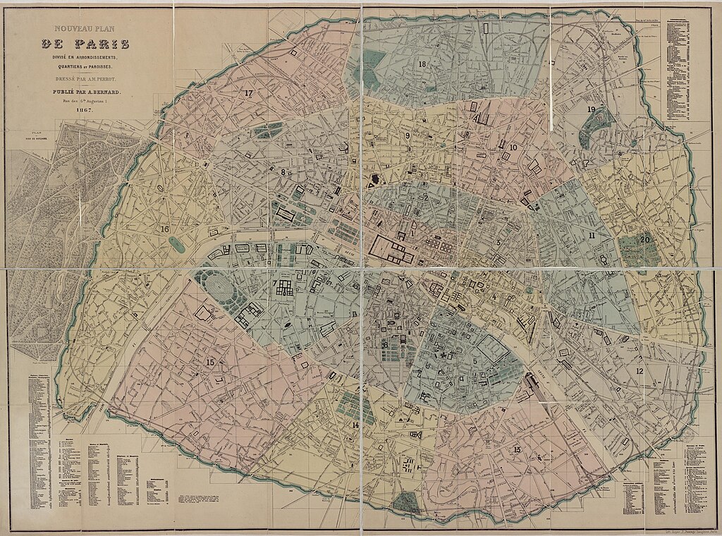
| Title |
Français : Nouveau plan de Paris divisé en arrondissements, quartiers et paroisses : 1867 / dressé par A. M. Perrot ; lith. Goyer |
||||||||||||||||||||
| Date | |||||||||||||||||||||
| Source | Bibliothèques spécialisées - Mairie de Paris | ||||||||||||||||||||
| Creator |
Aristide-Michel Perrot, Goyer |
||||||||||||||||||||
| Permission (Reusing this file) |
Term of use - Bibliothèques spécialisées de la Ville de Paris | ||||||||||||||||||||
| Geotemporal data | |||||||||||||||||||||
| Date depicted | |||||||||||||||||||||
| Map location | Paris | ||||||||||||||||||||
| Georeferencing | If inappropriate please set warp_status = skip to hide. | ||||||||||||||||||||
| Bibliographic data | |||||||||||||||||||||
| Language | french | ||||||||||||||||||||
| Place of publication | Paris | ||||||||||||||||||||
| Publisher |
A. Bernard |
||||||||||||||||||||
| Archival data | |||||||||||||||||||||
| Collection |
|
||||||||||||||||||||
| Dimensions | 1040 x 795 mm | ||||||||||||||||||||

Licensing edit
|
This work is in the public domain in its country of origin and other countries and areas where the copyright term is the author's life plus 100 years or fewer. | |
| This file has been identified as being free of known restrictions under copyright law, including all related and neighboring rights. | |
File history
Click on a date/time to view the file as it appeared at that time.
| Date/Time | Thumbnail | Dimensions | User | Comment | |
|---|---|---|---|---|---|
| current | 05:00, 22 September 2021 | | 6,261 × 4,649 (7.02 MB) | Paris 16 (talk | contribs) | Uploaded own work with UploadWizard |
You cannot overwrite this file.
File usage on Commons
The following 5 pages use this file: