File:Arkansas. Location of irrigated land - btv1b53200426s.jpg
Size of this preview: 653 × 600 pixels. Other resolutions: 261 × 240 pixels | 523 × 480 pixels | 836 × 768 pixels | 1,115 × 1,024 pixels | 2,229 × 2,048 pixels | 7,874 × 7,234 pixels.
Original file (7,874 × 7,234 pixels, file size: 6.27 MB, MIME type: image/jpeg)
Captions
Captions
Add a one-line explanation of what this file represents
Summary edit
| Warning | The original file is very high-resolution. It might not load properly or could cause your browser to freeze when opened at full size. |
|---|
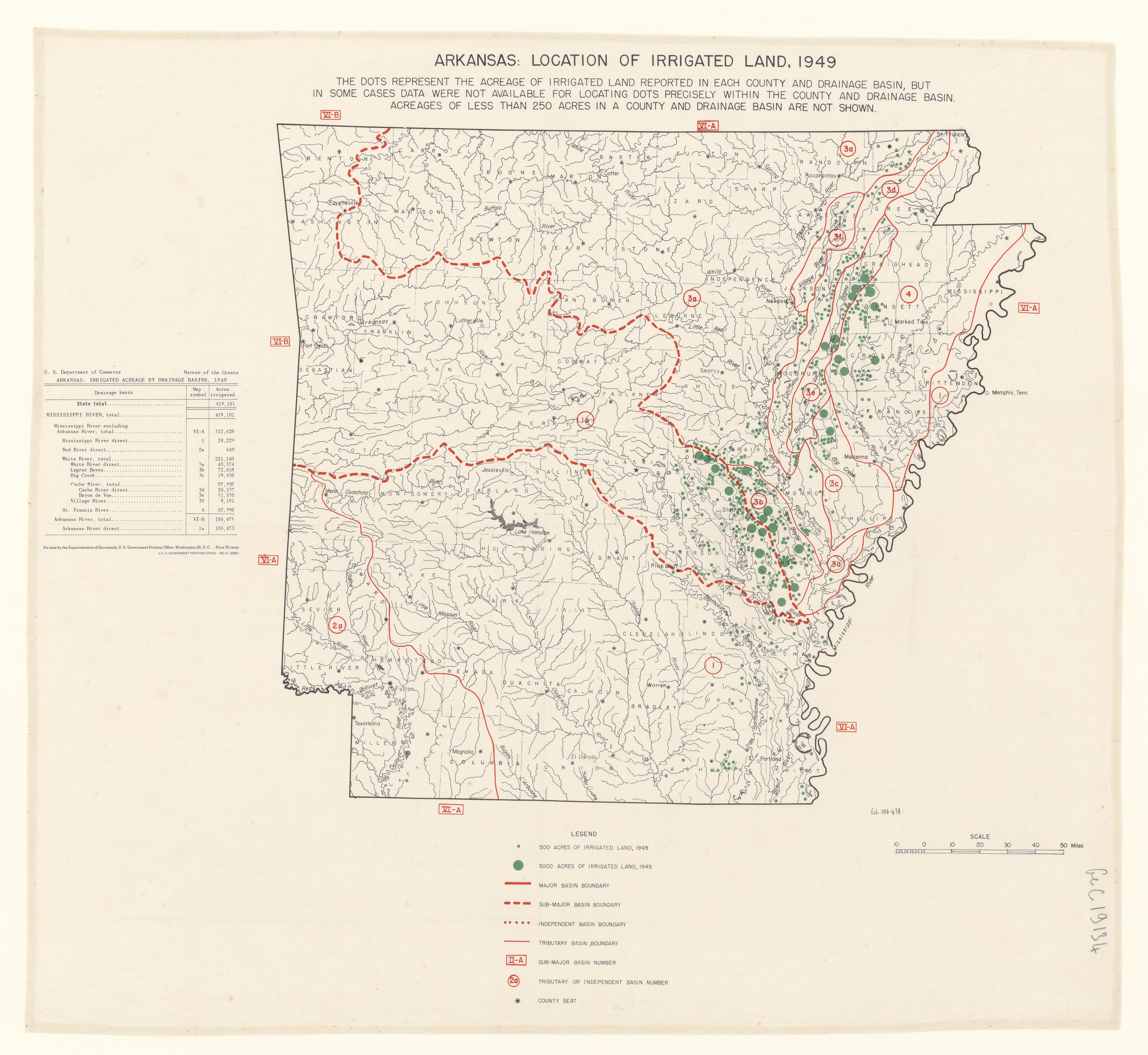
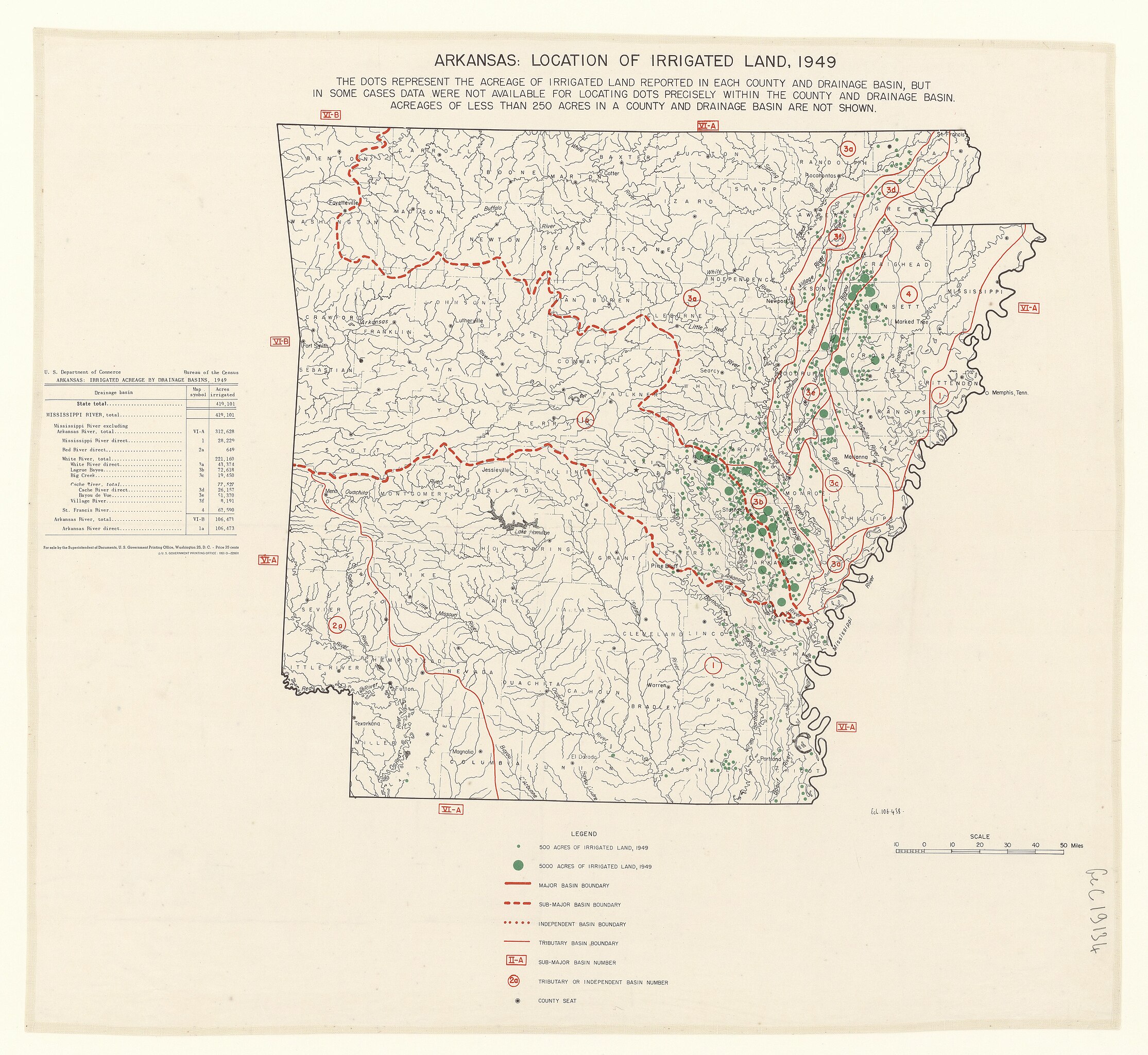
| Arkansas. Location of irrigated land
( |
|||||||||||||||||||||||||||
|---|---|---|---|---|---|---|---|---|---|---|---|---|---|---|---|---|---|---|---|---|---|---|---|---|---|---|---|
| Author |
Etats-Unis. Census bureau. Auteur du texte |
||||||||||||||||||||||||||
| Title |
Arkansas. Location of irrigated land |
||||||||||||||||||||||||||
| Description |
Français : Sujet : Irrigation
Arkansas, État d' -- Irrigation Échelle(s) : 50 miles [= 81mm. ; 1:1 000 000 ca] Couverture : États-Unis – Arkansas Langue : anglais Éditeur : Bureau of the Census (Washington) U.S. Department of Commerce (Washington) |
||||||||||||||||||||||||||
| Date | 1949 | ||||||||||||||||||||||||||
| Collection |
|
||||||||||||||||||||||||||
| References |
Français : Notice du catalogue : http://catalogue.bnf.fr/ark:/12148/cb40641956p |
||||||||||||||||||||||||||
| Source/Photographer |
Français : Bibliothèque nationale de France, département Cartes et plans, GE C-19134
Bibliothèque nationale de France |
||||||||||||||||||||||||||
| Permission (Reusing this file) |
|
||||||||||||||||||||||||||

File history
Click on a date/time to view the file as it appeared at that time.
| Date/Time | Thumbnail | Dimensions | User | Comment | |
|---|---|---|---|---|---|
| current | 21:11, 18 August 2022 | | 7,874 × 7,234 (6.27 MB) | Gzen92Bot (talk | contribs) | Gallica btv1b53200426s |
You cannot overwrite this file.
File usage on Commons
The following page uses this file: