File:ArmaghShape.png
No higher resolution available.
ArmaghShape.png (532 × 405 pixels, file size: 11 KB, MIME type: image/png)
Captions
Captions
Add a one-line explanation of what this file represents
Summary
edit
| Description |
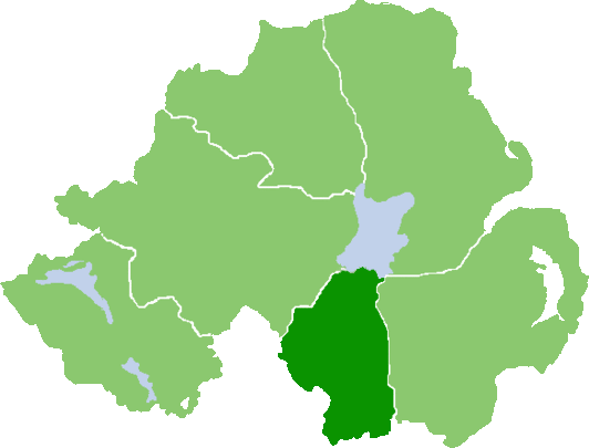
English: Outline map of County Armagh, Northern Ireland |
| Date | |
| Source | Own work (Original text: own work, based on :Image:NIShape.gif) |
| Author | User:Grutness, based on work of User:Setanta747 / Grutness at English Wikipedia |
Licensing
edit
| This work has been released into the public domain by its author, Grutness at English Wikipedia. This applies worldwide. In some countries this may not be legally possible; if so: Grutness grants anyone the right to use this work for any purpose, without any conditions, unless such conditions are required by law. |
Original upload log
edit
Transferred from en.wikipedia to Commons by Quadell using CommonsHelper.
The original description page was here. All following user names refer to en.wikipedia.
- 2008-07-07 07:58 Grutness 532×405× (10373 bytes) {{Information |Description=Outline map of County Armagh, Northern Ireland |Source=own work, based on [[:Image:NIShape.gif]] |Date=7/7/08 |Author=[[User:Grutness]], based on work of [[User:Setanta747]] |Permission={{PD-self}} |other_versions= }}
Original upload log
edit
| Date/Time | Dimensions | User | Comment |
|---|---|---|---|
| 25 July 2013, 15:29:37 | 532 × 405 (10373 bytes) | File Upload Bot (Magnus Manske) (talk · contribs) | Transfered from en.wikipedia by [[User:Quadell]] using CommonsHelper |
File history
Click on a date/time to view the file as it appeared at that time.
| Date/Time | Thumbnail | Dimensions | User | Comment | |
|---|---|---|---|---|---|
| current | 09:51, 18 August 2014 | | 532 × 405 (11 KB) | GifTagger (talk | contribs) | Bot: Converting file to superior PNG file. (Source: ArmaghShape.gif). This GIF was problematic due to transparency and non-greyscale color table. |
You cannot overwrite this file.
File usage on Commons
The following page uses this file:
- File:ArmaghShape.gif (file redirect)
File usage on other wikis
The following other wikis use this file:
- Usage on en.wikipedia.org
- Newry River
- Blackwatertown
- Darkley
- Ballymoyer
- Clea Lake
- Middletown, County Armagh
- Derryadd
- Acton, County Armagh
- Annahugh
- Ardress, County Armagh
- Broomhill, County Armagh
- Carrickaness
- Cladymore
- Collegeland, County Armagh
- Derryhale
- Edenaveys
- Kilmore, County Armagh
- Lisnadill
- Loughgilly
- Scotch Street
- Tartaraghan
- The Birches, County Armagh
- Dromintee
- Lislea
- Mullaghglass
- Newtowncloghoge
- Silverbridge, County Armagh
- Whitecross, County Armagh
- Ballydugan
- Creeveroe
- Granemore
- Killean, County Armagh
- Ballynagarrick
- Tullynawood
- Template:Armagh-geo-stub
- Derrycrew
- A50 road (Northern Ireland)
- A37 road (Northern Ireland)
- Maghery Country Park
- Camlough Fault
- Kinnegoe Fault
- Newry Fault
- Orlock Bridge Fault
- Armagh (barony)
- Oneilland West
- Oneilland East
- Orior Lower
- Orior Upper
- Fews Upper
- Fews Lower
View more global usage of this file.