File:Around the Peaks Loop FR 418 (29830291262).jpg
Original file (4,800 × 3,200 pixels, file size: 14.4 MB, MIME type: image/jpeg)
Captions
Captions
Summary
edit.jpg&action=edit§ion=1)
| Description |
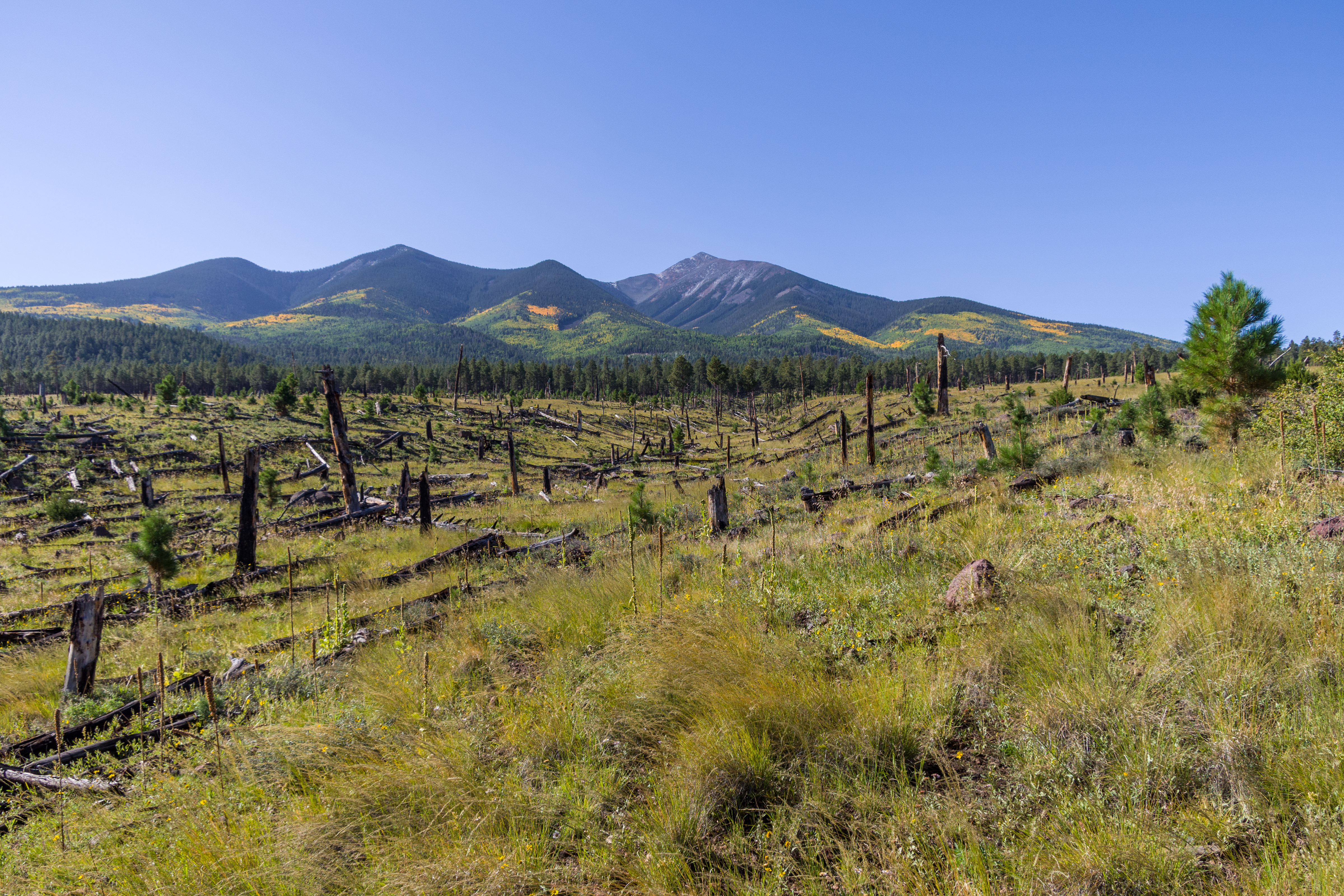
Fall color along Forest Road 418, September 23, 2016. This drive takes you all the way around Arizona's highest mountain, winding through a land of pine forests and aspen groves, open prairies and rustic homesteads. Autumn turns the mountain to gold, filling forest roads and trails with visitors come to enjoy the colorful display. Because the road becomes very rough and rocky between Bear Jaw and Abineau canyons, a mid to high clearance vehicle is required to complete the loop. However, fall color can be seen on either end of the road accessible to low clearance passenger cars. There are a number of places along this route where you can stop to take a hike, enjoy a lunch or even set up a primitive camp. That way you can take more than one day to do this drive or combine it with one or more of the other scenic drives in the vicinity of the San Francisco Peaks. Photo by Deborah Lee Soltesz, September 23, 2016. Source: U.S. Forest Service, Coconino National Forest. See <a href="http://www.fs.usda.gov/recarea/coconino/recreation/scenicdrivinginfo/recarea/?recid=75209&actid=105" rel="nofollow">Around the Peaks Loop Scenic Drive</a> for information about this drive on the <a href="http://coconinonationalforest.us/" rel="nofollow">Coconino National Forest</a> website. |
| Date | |
| Source | Around the Peaks Loop: FR 418 |
| Author | Coconino National Forest |
| Camera location | | View this and other nearby images on: OpenStreetMap |
|---|
.jpg¶ms=035.400510_N_-111.665955_E_globe:Earth_type:camera_source:Flickr_&language=en)
Licensing
edit.jpg&action=edit§ion=2)
| This image was originally posted to Flickr by Coconino National Forest at https://flickr.com/photos/42034606@N05/29830291262 (archive). It was reviewed on 8 September 2018 by FlickreviewR 2 and was confirmed to be licensed under the terms of the Public Domain Mark. |
This image or file is a work of a United States Department of Agriculture employee, taken or made as part of that person's official duties. As a work of the U.S. federal government, the image is in the public domain.
|
 |
File history
Click on a date/time to view the file as it appeared at that time.
| Date/Time | Thumbnail | Dimensions | User | Comment | |
|---|---|---|---|---|---|
| current | 07:20, 8 September 2018 | | 4,800 × 3,200 (14.4 MB) | Tyler ser Noche (talk | contribs) | Transferred from Flickr via #flickr2commons |
You cannot overwrite this file.
File usage on Commons
There are no pages that use this file.
.jpg&oldid=878109230)