File:Arrondissement Lons-le-Saunier.svg

Size of this PNG preview of this SVG file: 720 × 600 pixels. Other resolutions: 288 × 240 pixels | 576 × 480 pixels | 922 × 768 pixels | 1,229 × 1,024 pixels | 2,458 × 2,048 pixels | 1,895 × 1,579 pixels.
Original file (SVG file, nominally 1,895 × 1,579 pixels, file size: 240 KB)
Captions
Captions
Add a one-line explanation of what this file represents
Summary
edit
| Description |
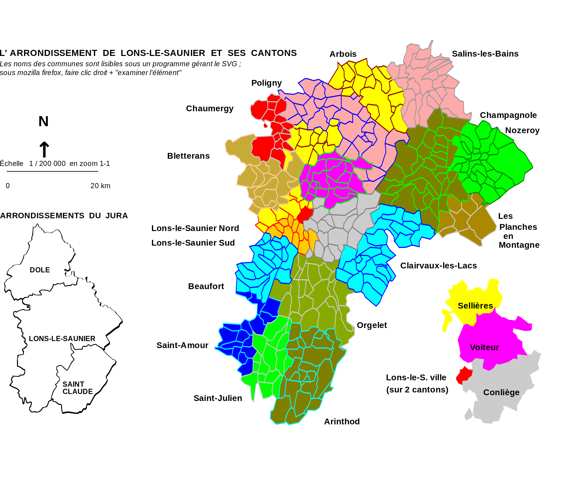
Français : Vue des divisions administratives de l'arrondissement de Lons-le-Saunier dans le département du Jura |
| Date | |
| Source |
Derived from File:Blank_Map_of_Jura_Department,_France,_with Communes.svg which was uploaded by Poulpy |
| Author | Michel421 |
| Permission (Reusing this file) |
Coordinates are taken from GEOFLA® Communes, a work of Institut géographique national, licensed under the Licence Ouverte. |
Licensing
edit
I, the copyright holder of this work, hereby publish it under the following license:
This file is licensed under the Creative Commons Attribution-Share Alike 3.0 Unported license.
- You are free:
- to share – to copy, distribute and transmit the work
- to remix – to adapt the work
- Under the following conditions:
- attribution – You must give appropriate credit, provide a link to the license, and indicate if changes were made. You may do so in any reasonable manner, but not in any way that suggests the licensor endorses you or your use.
- share alike – If you remix, transform, or build upon the material, you must distribute your contributions under the same or compatible license as the original.
File history
Click on a date/time to view the file as it appeared at that time.
| Date/Time | Thumbnail | Dimensions | User | Comment | |
|---|---|---|---|---|---|
| current | 12:46, 27 May 2012 | | 1,895 × 1,579 (240 KB) | Michel421 (talk | contribs) | changed some symbols/letters in order to avoid text/image overlap and oblic arrow in the PNG preview ; introduced a segment [0-20 km] as the scale 1/200000 applies in zoom 1-1 only. |
| 12:46, 27 May 2012 |  | 1,895 × 1,579 (240 KB) | Michel421 (talk | contribs) | changed some symbols/letters in order to avoid text/image overlap and oblic arrow in the PNG preview ; introduced a segment [0-20 km] as the scale 1/200000 applies in zoom 1-1 only. | |
| 22:33, 26 May 2012 |  | 1,895 × 1,579 (238 KB) | Michel421 (talk | contribs) |
You cannot overwrite this file.
File usage on Commons
The following page uses this file:
File usage on other wikis
The following other wikis use this file:
- Usage on fr.wikipedia.org
- Usage on it.wikipedia.org
- Usage on nl.wikipedia.org
- Usage on pl.wikipedia.org
- Usage on ro.wikipedia.org
- Usage on vi.wikipedia.org