File:As Pontes OSM.jpg
Size of this preview: 800 × 325 pixels. Other resolutions: 320 × 130 pixels | 640 × 260 pixels | 1,773 × 721 pixels.
Original file (1,773 × 721 pixels, file size: 330 KB, MIME type: image/jpeg)
Captions
Captions
Add a one-line explanation of what this file represents
Summary edit
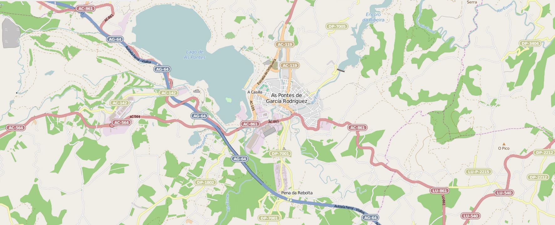
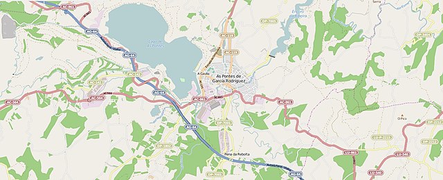
| Description |
Galego: Mapa de situación e comunicacións das Pontes de García Rodríguez |
|
| Date | ||
| Source | OpenStreetMap | |
| Author |
OpenStreetMap contributors
|

Licensing edit
This file is licensed under the Creative Commons Attribution-Share Alike 3.0 Unported license.
- You are free:
- to share – to copy, distribute and transmit the work
- to remix – to adapt the work
- Under the following conditions:
- attribution – You must give appropriate credit, provide a link to the license, and indicate if changes were made. You may do so in any reasonable manner, but not in any way that suggests the licensor endorses you or your use.
- share alike – If you remix, transform, or build upon the material, you must distribute your contributions under the same or compatible license as the original.
Original upload log edit
Transferred from gl.wikipedia to Commons using For the Common Good.
The original description page was here. All following user names refer to gl.wikipedia.
| Date/Time | Dimensions | User | Comment |
|---|---|---|---|
| 12:42, 10 April 2015 | 1,773 × 721 (338,149 bytes) | w:gl:Banjo (talk | contribs) | {{Information |Description= Mapa de situación e comunicacións de [[As Pontes de García Rodríguez]] |Source= [https://www.openstreetmap.org/#map=13/43.4458/-7.8523&layers=N OpenStreetMap]] |Date= 10 de abril de 2015 |Author= Colaboradores de OpenStr... |
File history
Click on a date/time to view the file as it appeared at that time.
| Date/Time | Thumbnail | Dimensions | User | Comment | |
|---|---|---|---|---|---|
| current | 09:42, 6 August 2015 | 1,773 × 721 (330 KB) | Banjo (talk | contribs) | Transferred from gl.wikipedia: see original upload log above |
You cannot overwrite this file.
File usage on Commons
There are no pages that use this file.