File:Asia-Durian.png

Size of this preview: 788 × 600 pixels. Other resolutions: 316 × 240 pixels | 631 × 480 pixels | 1,009 × 768 pixels | 1,280 × 974 pixels.
Original file (1,280 × 974 pixels, file size: 222 KB, MIME type: image/png)
Captions
Captions
Add a one-line explanation of what this file represents

|
File:Durian native and exotic range map.svg is a vector version of this file. It should be used in place of this PNG file.
File:Asia-Durian.png → File:Durian native and exotic range map.svg
For more information, see Help:SVG. |
 |
Summary
edit
| Description |
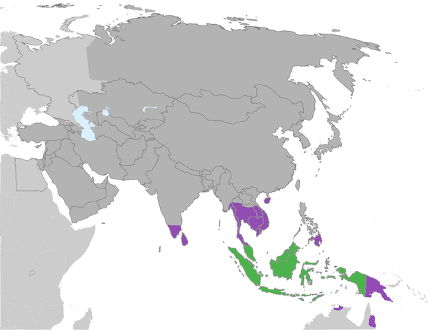
English: Distribution of the Durian |
| Date | |
| Source | File:Location_Map_Asia.svg |
| Author |
Original map: User:Haha169 Modified map: User:Hippo99 |
Licensing
edit
| This file is made available under the Creative Commons CC0 1.0 Universal Public Domain Dedication. | |
| The person who associated a work with this deed has dedicated the work to the public domain by waiving all of their rights to the work worldwide under copyright law, including all related and neighboring rights, to the extent allowed by law. You can copy, modify, distribute and perform the work, even for commercial purposes, all without asking permission.
|
File history
Click on a date/time to view the file as it appeared at that time.
| Date/Time | Thumbnail | Dimensions | User | Comment | |
|---|---|---|---|---|---|
| current | 13:48, 26 September 2022 | | 1,280 × 974 (222 KB) | Рагин1987 (talk | contribs) | More correct visualization of the dividing line on the territory of the Caucasus Range |
| 18:24, 5 May 2015 |  | 1,280 × 974 (257 KB) | MrRainbows (talk | contribs) | Colorblind friendly version. | |
| 15:13, 5 May 2015 |  | 1,280 × 974 (257 KB) | Jynto (talk | contribs) | Changing one of the map colours because it was difficult to see the difference. Hi Reddit. | |
| 08:55, 31 January 2015 |  | 1,280 × 974 (205 KB) | Hippo99 (talk | contribs) | == {{int:filedesc}} == {{Information |description = {{en|1=Distribution of the Durian}} |date = 2015-01-31 |source = http://commons.wikimedia.org/wiki/File:Location_Map_Asia.svg |author = Original map: User:Haha169<br /... |
You cannot overwrite this file.
File usage on Commons
The following page uses this file:
File usage on other wikis
The following other wikis use this file:
- Usage on species.wikimedia.org