File:Assab volcanic field.jpg
No higher resolution available.
Assab_volcanic_field.jpg (635 × 480 pixels, file size: 71 KB, MIME type: image/jpeg)
Captions
Captions
Add a one-line explanation of what this file represents
Summary edit
| Description |
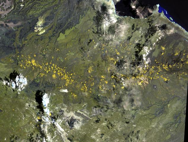
English: The long chain of pyroclastic cones and lava flows extending East-West across this Landsat image is the Assab volcanic field near the Red Sea coast in southern Eritrea.
|
| Date | |
| Source | http://www.volcano.si.edu/world/volcano.cfm?vnum=0201-125&volpage=photos&photo=111076 |
| Author | NASA Landsat image (courtesy of Hawaii Synergy Project, Univ. of Hawaii Institute of Geophysics & Planetology) |
Licensing edit
| This file is in the public domain in the United States because it was solely created by NASA. NASA copyright policy states that "NASA material is not protected by copyright unless noted". (See Template:PD-USGov, NASA copyright policy page or JPL Image Use Policy.) | ||
 |
Warnings:
|
File history
Click on a date/time to view the file as it appeared at that time.
| Date/Time | Thumbnail | Dimensions | User | Comment | |
|---|---|---|---|---|---|
| current | 13:51, 30 October 2010 | | 635 × 480 (71 KB) | Michael Metzger (talk | contribs) | {{Information |Description={{en|1=The long chain of pyroclastic cones and lava flows extending East-West across this Landsat image is the Assab volcanic field near the Red Sea coast in southern Eritrea. This spectacular range of basaltic cinder cones and |
You cannot overwrite this file.
File usage on Commons
There are no pages that use this file.
File usage on other wikis
The following other wikis use this file:
- Usage on ar.wikipedia.org
- Usage on bn.wikipedia.org
- Usage on ca.wikipedia.org
- Usage on cs.wikipedia.org
- Usage on de.wikipedia.org
- Usage on en.wikipedia.org
- Usage on fa.wikipedia.org
- Usage on fr.wikipedia.org
- Usage on lld.wikipedia.org
- Usage on ro.wikipedia.org
- Usage on ru.wikipedia.org
- Usage on sk.wikipedia.org
- Usage on uk.wikipedia.org
- Usage on www.wikidata.org