File:Assale NASA.jpg
No higher resolution available.
Assale_NASA.jpg (392 × 408 pixels, file size: 67 KB, MIME type: image/jpeg)
Captions
Captions
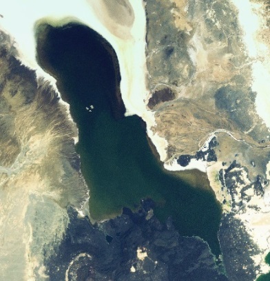
Lake Assale (Karum) in Ethiopia
Summary
edit
| Description |
Русский: Озеро Ассале на плато Данакиль в Эфиопии (зелёным цветом)
English: Lake Assale (Karum, Asale, Asahle) is located in the Danakil Depression in Ethiopia (green color) |
| Date | Unknown date |
| Source | Screenshot from NASA World Wind software, Blue Marble & Landsat layer or Blue Marble layer |
| Author | NASA |
| Object location | | View this and other nearby images on: OpenStreetMap |
|---|
Licensing
edit
| This image is in the public domain because it is a screenshot from NASA’s globe software World Wind using a public domain layer, such as Blue Marble, MODIS, Landsat, SRTM, USGS or GLOBE.
|
 |
File history
Click on a date/time to view the file as it appeared at that time.
| Date/Time | Thumbnail | Dimensions | User | Comment | |
|---|---|---|---|---|---|
| current | 20:03, 11 June 2022 | | 392 × 408 (67 KB) | Proeksad (talk | contribs) | Uploaded a work by NASA from Screenshot from NASA World Wind software, Blue Marble & Landsat layer or Blue Marble layer with UploadWizard |
You cannot overwrite this file.
File usage on Commons
There are no pages that use this file.
File usage on other wikis
The following other wikis use this file:
- Usage on ru.wikipedia.org
- Usage on vi.wikipedia.org