File:Assistance for the blind (7029302447).jpg

Size of this preview: 800 × 600 pixels. Other resolutions: 320 × 240 pixels | 640 × 480 pixels | 1,024 × 768 pixels | 1,280 × 960 pixels | 2,560 × 1,920 pixels | 4,000 × 3,000 pixels.
Original file (4,000 × 3,000 pixels, file size: 2.62 MB, MIME type: image/jpeg)
Captions
Captions
Add a one-line explanation of what this file represents
Summary
edit.jpg&action=edit§ion=1)
| Description |
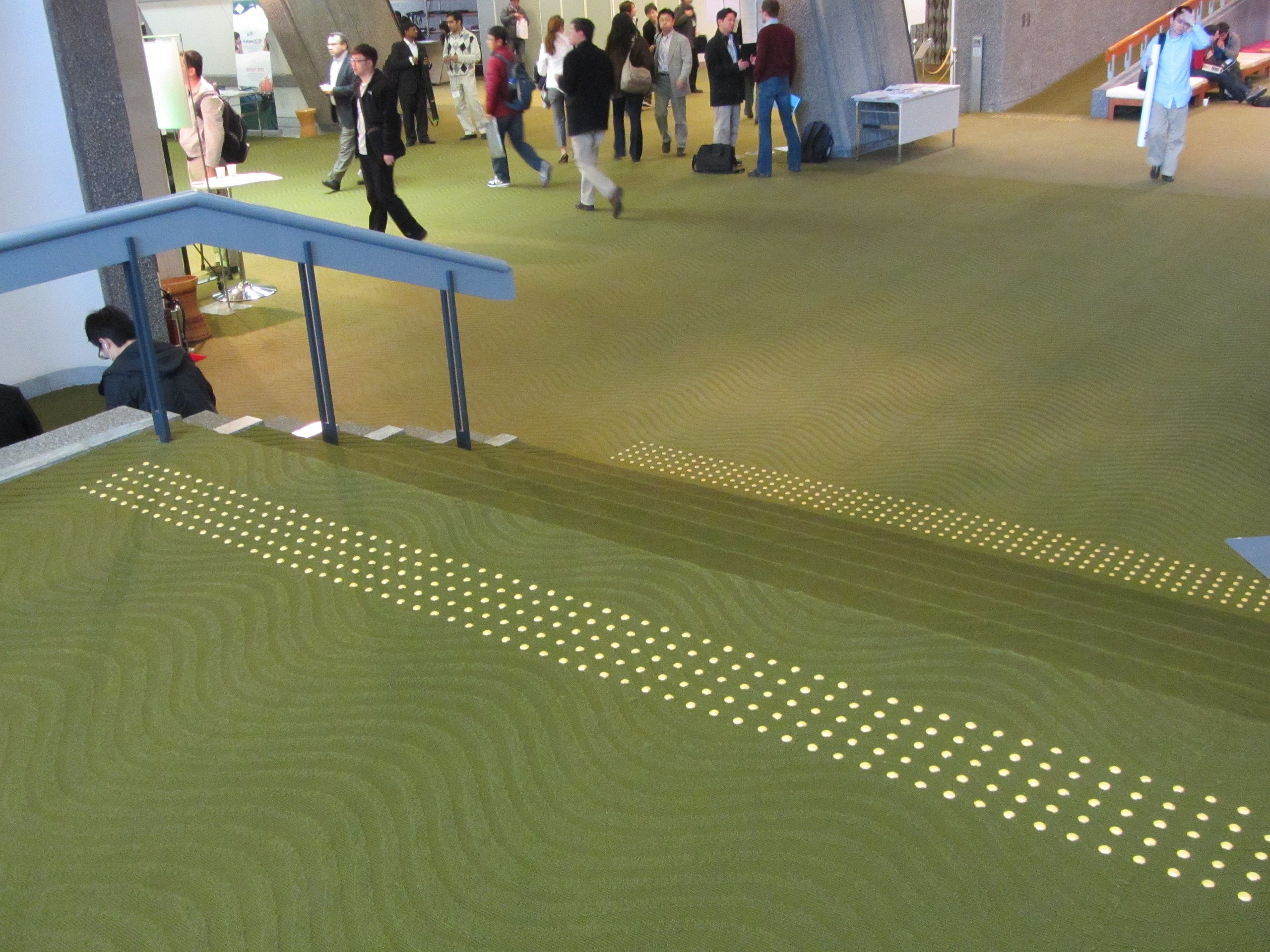
Throughout town, there are textured areas on the sidewalks and other places. Took me a while to realize why: Assist the blind in navigation. Dots mean a change (stairs, ramp, turn), lines mean a straight path, and longer dots mean a curve. Simple, clean help. The only odd bit... These occur in restrooms as well, but not in the same relative place. One sink will have two textured pads to assist in placement, but the sink could be any of the sinks. |
| Date | |
| Source | Assistance for the blind |
| Author | Jason Riedy |
| Camera location | | View this and other nearby images on: OpenStreetMap |
|---|
.jpg¶ms=035.060883_N_0135.783172_E_globe:Earth_type:camera_source:Flickr_&language=en)
Licensing
edit.jpg&action=edit§ion=2)
This file is licensed under the Creative Commons Attribution 2.0 Generic license.
- You are free:
- to share – to copy, distribute and transmit the work
- to remix – to adapt the work
- Under the following conditions:
- attribution – You must give appropriate credit, provide a link to the license, and indicate if changes were made. You may do so in any reasonable manner, but not in any way that suggests the licensor endorses you or your use.
| This image was originally posted to Flickr by Jason Riedy at https://flickr.com/photos/66142667@N00/7029302447. It was reviewed on 11 September 2015 by FlickreviewR and was confirmed to be licensed under the terms of the cc-by-2.0. |
File history
Click on a date/time to view the file as it appeared at that time.
| Date/Time | Thumbnail | Dimensions | User | Comment | |
|---|---|---|---|---|---|
| current | 03:01, 11 September 2015 | | 4,000 × 3,000 (2.62 MB) | Benzoyl (talk | contribs) | Transferred from Flickr via Flickr2Commons |
You cannot overwrite this file.
File usage on Commons
There are no pages that use this file.
.jpg&oldid=885071299)