File:AtHistEur1811.jpg
Size of this preview: 549 × 599 pixels. Other resolutions: 220 × 240 pixels | 440 × 480 pixels | 703 × 768 pixels | 938 × 1,024 pixels | 1,284 × 1,402 pixels.
Original file (1,284 × 1,402 pixels, file size: 223 KB, MIME type: image/jpeg)
Captions
Captions
Add a one-line explanation of what this file represents
Summary edit
| Description |
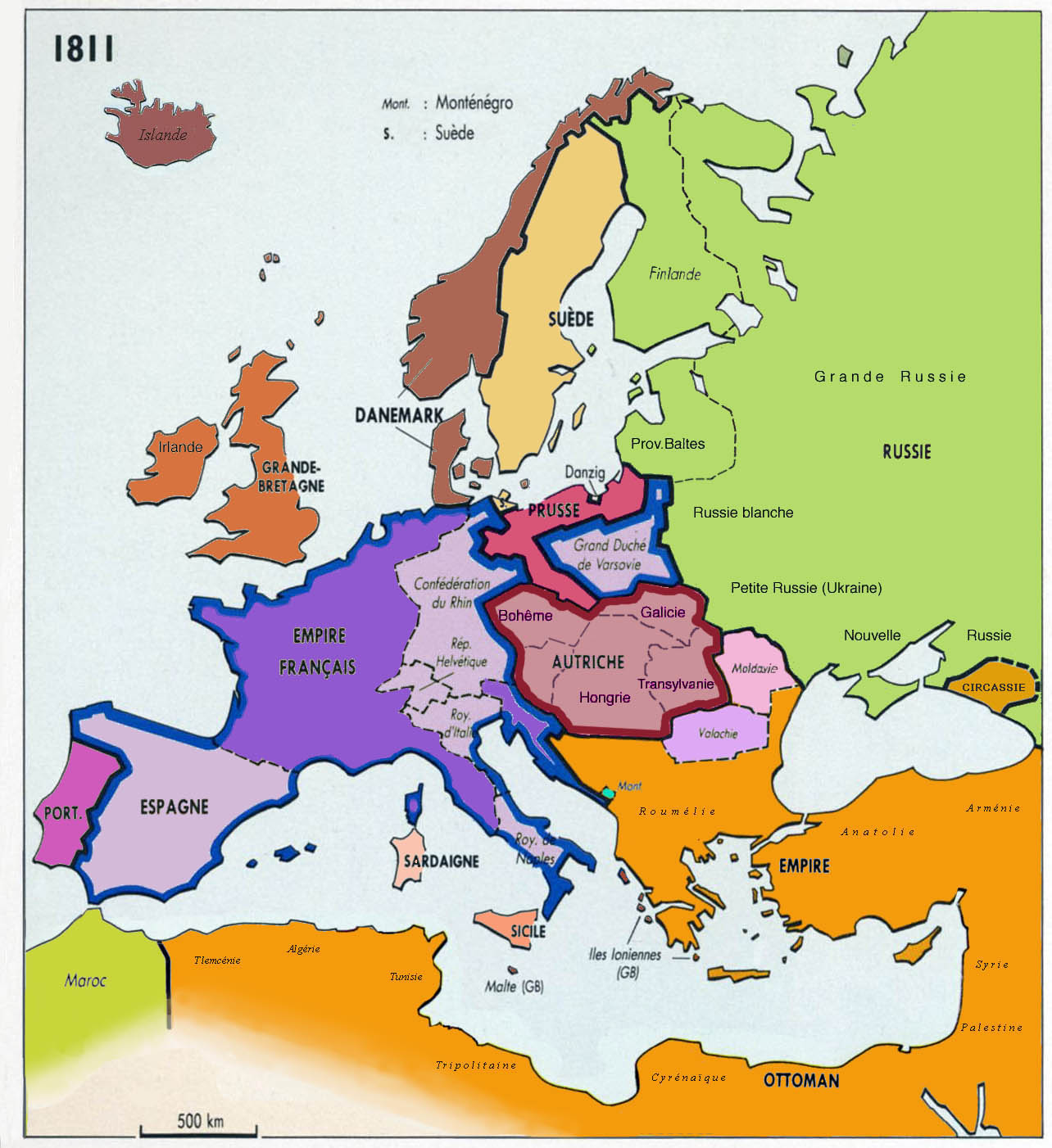
English: Historical map of Europe, year 1811, since Putzgers Historischer Schul-Atlas & Anne Le Fur
Français : Carte historique de l'Europe en 1811 d'après Putzgers Historischer Schul-Atlas et Anne Le Fur |
| Date | |
| Source | Own work |
| Author | Spiridon MANOLIU |
Détails des empires d'Autriche, russe et ottoman, tels qu'ils figurent sur les cartes de l'époque.
Licensing edit
I, the copyright holder of this work, hereby publish it under the following licenses:

|
Permission is granted to copy, distribute and/or modify this document under the terms of the GNU Free Documentation License, Version 1.2 or any later version published by the Free Software Foundation; with no Invariant Sections, no Front-Cover Texts, and no Back-Cover Texts. A copy of the license is included in the section entitled GNU Free Documentation License. |
This file is licensed under the Creative Commons Attribution-Share Alike 3.0 Unported, 2.5 Generic, 2.0 Generic and 1.0 Generic license.
- You are free:
- to share – to copy, distribute and transmit the work
- to remix – to adapt the work
- Under the following conditions:
- attribution – You must give appropriate credit, provide a link to the license, and indicate if changes were made. You may do so in any reasonable manner, but not in any way that suggests the licensor endorses you or your use.
- share alike – If you remix, transform, or build upon the material, you must distribute your contributions under the same or compatible license as the original.
You may select the license of your choice.
File history
Click on a date/time to view the file as it appeared at that time.
| Date/Time | Thumbnail | Dimensions | User | Comment | |
|---|---|---|---|---|---|
| current | 17:07, 8 March 2009 | | 1,284 × 1,402 (223 KB) | Spiridon Ion Cepleanu (talk | contribs) | {{Information |Description={{en|1=Historical map of Europe, year 1811}} {{fr|1=Carte historique de l'Europe en 1811 d'après Anne Le Fur}} |Source=travail personnel (own work) |Author=Spiridon MANOLIU |Date=March 8, 2009 |Permiss |
You cannot overwrite this file.
File usage on Commons
The following page uses this file:
File usage on other wikis
The following other wikis use this file:
- Usage on af.wikipedia.org
- Usage on de.wikipedia.org
- Usage on et.wikipedia.org
- Usage on fr.wikipedia.org
- Usage on gl.wikipedia.org