File:Atchafalaya Basin Floodway.jpg

Size of this preview: 400 × 600 pixels. Other resolutions: 160 × 240 pixels | 320 × 480 pixels.
Original file (800 × 1,200 pixels, file size: 111 KB, MIME type: image/jpeg)
Captions
Captions
Add a one-line explanation of what this file represents
Summary edit
| Description |
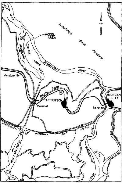
English: Map of the Atchafalaya River and the Wax Lake Outlet Channel in Southern Louisiana, USA (http://www.dtic.mil/cgi-bin/GetTRDoc?AD=ADA199971&Location=U2&doc=GetTRDoc.pdf) |
| Date | |
| Source | Davidson, Robert A. (1988). Wax Lake Outlet control structure, Louisiana: hydraulic model investigation. Vicksburg, Mississippi: US Army Corps of Engineers, Hydraulics Laboratory. |
| Author | Davidson, Robert A., United States Army Corps of Engineers |
Licensing edit
This file is a work of a U.S. Army soldier or employee, taken or made as part of that person's official duties. As a work of the U.S. federal government, it is in the public domain in the United States.
|
 |
File history
Click on a date/time to view the file as it appeared at that time.
| Date/Time | Thumbnail | Dimensions | User | Comment | |
|---|---|---|---|---|---|
| current | 19:26, 1 June 2011 | | 800 × 1,200 (111 KB) | Kkmurray (talk | contribs) | {{Information |Description ={{en|1=Map of the Atchafalaya River and the Wax Lake Outlet Channel in Southern Louisiana, USA (http://www.dtic.mil/cgi-bin/GetTRDoc?AD=ADA199971&Location=U2&doc=GetTRDoc.pdf)}} |Source =Davidson, Robert A. (1988). W |
You cannot overwrite this file.
File usage on Commons
The following page uses this file: