File:Atla mõisa peahoone.jpg

Size of this preview: 800 × 415 pixels. Other resolutions: 320 × 166 pixels | 640 × 332 pixels | 1,024 × 531 pixels | 1,280 × 664 pixels | 2,560 × 1,328 pixels | 7,248 × 3,760 pixels.
Original file (7,248 × 3,760 pixels, file size: 21.38 MB, MIME type: image/jpeg)
Captions
Captions
Add a one-line explanation of what this file represents
Summary
edit
| Description |
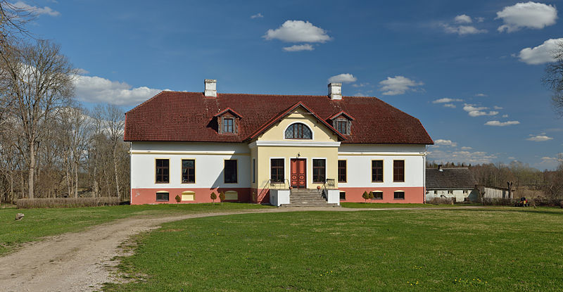
Eesti: Atla mõisa peahoone English: Atla manor main building |
| Date | |
| Source | Own work |
| Author | Ivar Leidus |
| Camera location | | View this and other nearby images on: OpenStreetMap |
|---|
| Camera Model | Nikon D5200 |
|---|---|
| Shutter speed | 1/160; |
| Aperture | f/8; |
| Film speed (ISO) | 100; |
| Focal length | 40 mm; |
| Filter(s) | Hoya CIR-PL |
This image was created with Hugin.
Licensing
edit
I, the copyright holder of this work, hereby publish it under the following license:
This file is licensed under the Creative Commons Attribution-ShareAlike 3.0 Estonia license.
- You are free:
- to share – to copy, distribute and transmit the work
- to remix – to adapt the work
- Under the following conditions:
- attribution – You must give appropriate credit, provide a link to the license, and indicate if changes were made. You may do so in any reasonable manner, but not in any way that suggests the licensor endorses you or your use.
- share alike – If you remix, transform, or build upon the material, you must distribute your contributions under the same or compatible license as the original.

This image has been assessed using the Quality image guidelines and is considered a Quality image.
|
File history
Click on a date/time to view the file as it appeared at that time.
| Date/Time | Thumbnail | Dimensions | User | Comment | |
|---|---|---|---|---|---|
| current | 17:47, 11 May 2013 | | 7,248 × 3,760 (21.38 MB) | Iifar (talk | contribs) | User created page with UploadWizard |
You cannot overwrite this file.
File usage on Commons
The following 4 pages use this file:
File usage on other wikis
The following other wikis use this file:
- Usage on ceb.wikipedia.org
- Usage on cv.wikipedia.org
- Usage on en.wikipedia.org
- Usage on es.wikipedia.org
- Usage on et.wikipedia.org
- Usage on fr.wikipedia.org
- Usage on hy.wikipedia.org
- Usage on pl.wikipedia.org
- Usage on ru.wikipedia.org
- Usage on sco.wikipedia.org
- Usage on tt.wikipedia.org
- Usage on www.wikidata.org
- Usage on zh-min-nan.wikipedia.org