File:Atlas and farmers' directory of Swift County, Minnesota - containing plats of all townships with owners' names, an outline map of the county and a state map of Minnesota, compiled from latest data LOC 2008622001-25.jpg

Size of this preview: 431 × 599 pixels. Other resolutions: 173 × 240 pixels | 345 × 480 pixels | 552 × 768 pixels | 736 × 1,024 pixels | 1,779 × 2,473 pixels.
Original file (1,779 × 2,473 pixels, file size: 663 KB, MIME type: image/jpeg)
Captions
Captions
Add a one-line explanation of what this file represents
Summary edit
| Description |
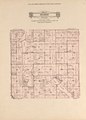
English: "On township maps township roads are shown with parallel lines, rural routes are shown with broken black lines, location of farm buildings is shown with black square, school district boundary lines are shown with feathered edge." Available also through the Library of Congress Web site as a raster image. Includes indexes and advertisements. Annotations in pencil on some maps. Vendor: Stephen Peterson, Bookseller, Richfield, MN Acquisitions control no. 2007-188 |
||
| Title | Atlas and farmers' directory of Swift County, Minnesota : containing plats of all townships with owners' names, an outline map of the county and a state map of Minnesota, compiled from latest data on record and from personal investigation. | ||
| Shelf ID | G1428.S9 W4 1931 | ||
| Parent | https://www.loc.gov/resource/g4143sm.gla00076/ | ||
| Sheet title | Hegbert | ||
| Date | |||
| Source | https://www.loc.gov/item/2008622001/ | ||
| Author | Webb Publishing Co. | ||
| Permission (Reusing this file) |
|
||
| Other versions |
|
||
| Location | Minnesota--Swift County · Swift County (Minn.) | ||
| Part of | American Memory · Catalog · County Landownership Maps · Geography And Map Division · Cultural Landscapes | ||
| Subject | United States · Directories · Minnesota · Swift County · Swift County (Minn.) · Maps · Real Property · Landowners |

Licensing edit
This work is in the public domain in the United States because it is a work prepared by an officer or employee of the United States Government as part of that person’s official duties under the terms of Title 17, Chapter 1, Section 105 of the US Code.
Note: This only applies to original works of the Federal Government and not to the work of any individual U.S. state, territory, commonwealth, county, municipality, or any other subdivision. This template also does not apply to postage stamp designs published by the United States Postal Service since 1978. (See § 313.6(C)(1) of Compendium of U.S. Copyright Office Practices). It also does not apply to certain US coins; see The US Mint Terms of Use.
|
 | |
| This file has been identified as being free of known restrictions under copyright law, including all related and neighboring rights. | ||
File history
Click on a date/time to view the file as it appeared at that time.
| Date/Time | Thumbnail | Dimensions | User | Comment | |
|---|---|---|---|---|---|
| current | 04:53, 9 November 2018 | | 1,779 × 2,473 (663 KB) | Fæ (talk | contribs) | LOC Maps multisheet https://www.loc.gov/item/2008622001/ sheet 25 of 51 #8260 |
You cannot overwrite this file.
File usage on Commons
The following page uses this file: