File:Atlas des anciens plans de Paris - 037. Paris de 1285 à 1314 - David Rumsey.jpg

Size of this preview: 427 × 599 pixels. Other resolutions: 171 × 240 pixels | 342 × 480 pixels | 547 × 768 pixels | 729 × 1,024 pixels | 1,459 × 2,048 pixels | 12,502 × 17,552 pixels.
Original file (12,502 × 17,552 pixels, file size: 54.82 MB, MIME type: image/jpeg)
Captions
Captions
A page of book.

|
This file has been superseded by Atlas des anciens plans de Paris - Paris de 1285 à 1314 - David Rumsey.jpg. It is recommended to use the other file. Please note that deleting superseded images requires consent.
|

|
Summary
edit
| Warning | The original file is very high-resolution. It might not load properly or could cause your browser to freeze when opened at full size. |
|---|
| Title |
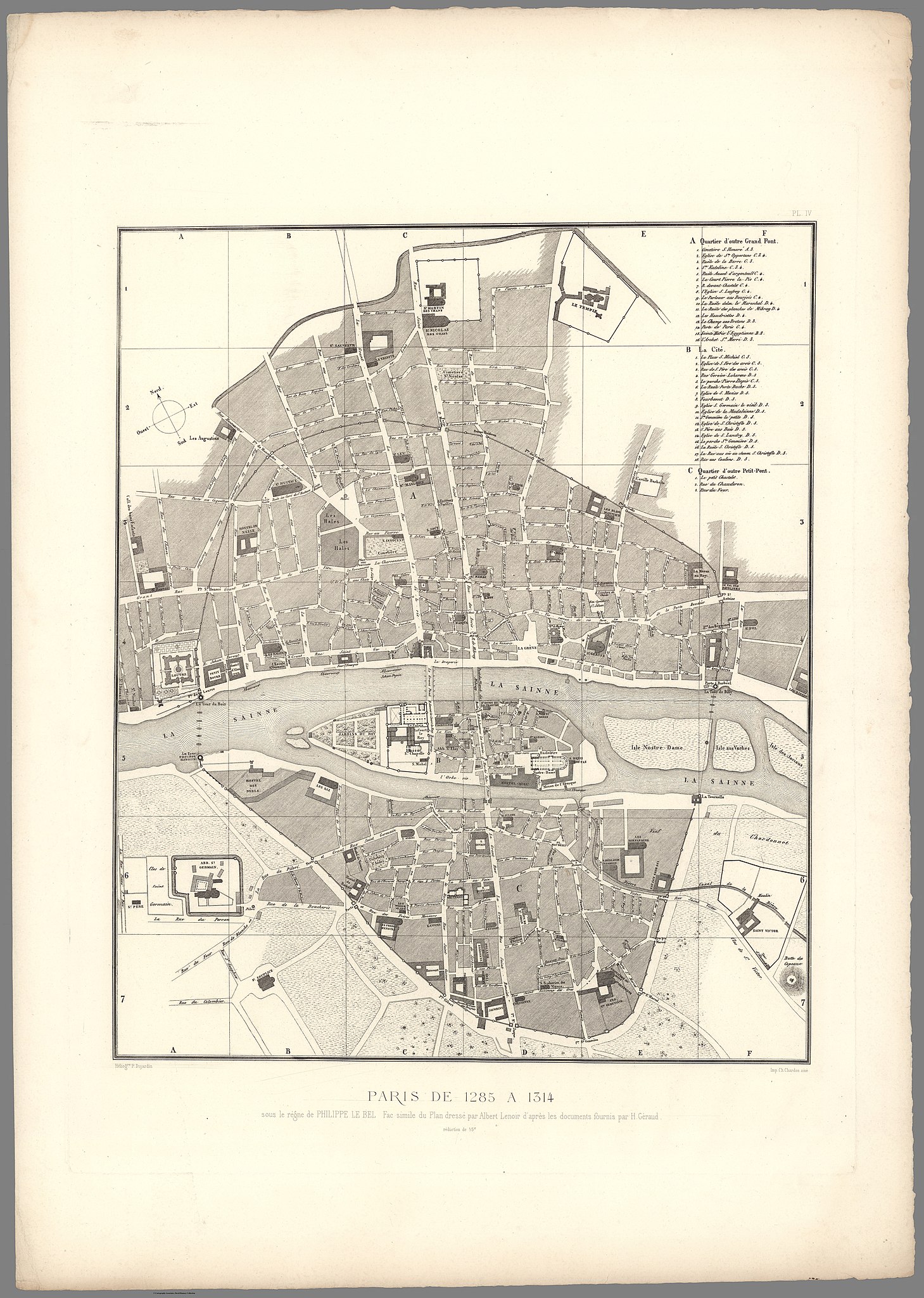
Paris de 1285 à 1314, sous le règne de Philippe le Bel |
| Description |
English: An old map of Paris from Histoire Générale de Paris. Atlas des Anciens plans de Paris. Looseleaf atlas of facsimile rare historical maps of Paris with explanatory text. Uses heliogravure process to create very detailed reproductions. |
| Date | |
| Source | David Rumsey Historical Map Collection |
| Creator |
Albert Lenoir |
| Geotemporal data | |
| Date depicted | |
| Map location | Paris |
| Georeferencing | If inappropriate please set warp_status = skip to hide. |
| Bibliographic data | |
| Publication |
Histoire Générale de Paris. Atlas des Anciens plans de Paris. Reproduction en fac-similé des originaux les plus rares et les plus intéressants pour l'histoire de la topographie parisienne, avec une table analytique... (Troisième tirage). Paris. Imprimerie nationale. MDCCCC. |
| Place of publication | Paris |
| Publisher |
Imprimerie nationale |
| Printed by |
Charles Chardon |
| Archival data | |
| Collection | David Rumsey Historical Map Collection |
| Medium | Atlas map |
Licensing
edit
|
This work is in the public domain in its country of origin and other countries and areas where the copyright term is the author's life plus 100 years or fewer. | |
| This file has been identified as being free of known restrictions under copyright law, including all related and neighboring rights. | |
File history
Click on a date/time to view the file as it appeared at that time.
| Date/Time | Thumbnail | Dimensions | User | Comment | |
|---|---|---|---|---|---|
| current | 19:55, 2 January 2020 | | 12,502 × 17,552 (54.82 MB) | Paris 16 (talk | contribs) | User created page with UploadWizard |
You cannot overwrite this file.
File usage on Commons
There are no pages that use this file.