File:Atlas of the Philippine Islands 1899 (maps only).pdf

Size of this JPG preview of this PDF file: 706 × 600 pixels. Other resolutions: 283 × 240 pixels | 565 × 480 pixels | 904 × 768 pixels | 1,205 × 1,024 pixels | 1,497 × 1,272 pixels.

Original file (1,497 × 1,272 pixels, file size: 24.52 MB, MIME type: application/pdf, 30 pages)
Captions
Captions
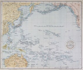
A series of maps of the Philippine Islands, taken from the 1899/1900 atlas.
Summary
edit| Description |
English: Shortly after the Philippine commissioners reached Manila it was learned that a series of maps, covering the more important islands of the archipelago, was being prepared at the Jesuit Observatory under the supervision of the director, Rev. José Algue, S. J.
An inspection of such of the maps as already had been completed satisfied the commission that they were superior to anything hitherto published. It was learned that the Jesuit Fathers planned to make the series quite complete, but that they had no very definite ideas as to when the work would be completed or how the maps would be published eventually. The commission conceived the idea of securing their cooperation in the preparation of a comprehensive atlas of the archipelago, and with this end in view asked them to submit a tentative list of maps. The request was promptly complied with. After some discussion the series here published was decided upon, and an arrangement was entered into whereby it should be completed and become the property of the commission by August 15. 1899. |
| Date | |
| Source | Google Books of the philippine islands&f=false |
| Author | Observatorio de Manila (director: P. José Algué, S. J.); U. S. Coast and Geodetic Survey (superintendent: Henry S. Pritchett) |
| Other versions | File:Atlas de Filipinas.djvu |
Licensing
editThis work is in the public domain in the United States because it was published (or registered with the U.S. Copyright Office) before January 1, 1929.
Public domain works must be out of copyright in both the United States and in the source country of the work in order to be hosted on the Commons. If the work is not a U.S. work, the file must have an additional copyright tag indicating the copyright status in the source country.
Note: This tag should not be used for sound recordings. |
File history
Click on a date/time to view the file as it appeared at that time.
| Date/Time | Thumbnail | Dimensions | User | Comment | |
|---|---|---|---|---|---|
| current | 16:59, 18 July 2023 |  | 1,497 × 1,272, 30 pages (24.52 MB) | Monedula (talk | contribs) | Uploaded a work by Observatorio de Manila (director: P. José Algué, S. J.); U. S. Coast and Geodetic Survey (superintendent: Henry S. Pritchett) from Google Books [https://books.google.ru/books?id=J48-39nfuA8C&newbks=0&printsec=frontcover&dq=atlas+of+the+philippine+islands&hl=en&source=newbks_fb&redir_esc=y#v=onepage&q=atlas of the philippine islands&f=false] with UploadWizard |
You cannot overwrite this file.
File usage on Commons
There are no pages that use this file.