File:Atlas zur Geschichte Dresdens Tafel 27 b (cropped).jpg

Size of this preview: 751 × 600 pixels. Other resolutions: 301 × 240 pixels | 601 × 480 pixels | 962 × 768 pixels | 1,280 × 1,022 pixels | 2,560 × 2,045 pixels | 8,668 × 6,924 pixels.
Original file (8,668 × 6,924 pixels, file size: 33.04 MB, MIME type: image/jpeg)
Captions
Captions
Add a one-line explanation of what this file represents
Summary
edit| Description |
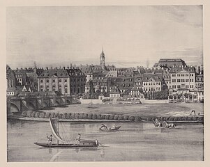
Deutsch: Atlas zur Geschichte Dresdens. Tafel 27b – Südliche Ansicht von Neustadt-Dresden um das Jahr 1800.
Veröffentlichung des Vereins für Geschichte Dresdens. |
| Date | |
| Source | Self-scanned |
| Author | Herausgeber: Otto Richter (1852–1922) |
| Other versions |

.jpg&action=edit§ion=1)
Licensing
edit.jpg&action=edit§ion=2)
|
This work is in the public domain in its country of origin and other countries and areas where the copyright term is the author's life plus 70 years or fewer. This work is in the public domain in the United States because it was published (or registered with the U.S. Copyright Office) before January 1, 1929. | |
| This file has been identified as being free of known restrictions under copyright law, including all related and neighboring rights. | |
File history
Click on a date/time to view the file as it appeared at that time.
| Date/Time | Thumbnail | Dimensions | User | Comment | |
|---|---|---|---|---|---|
| current | 13:59, 17 May 2023 | | 8,668 × 6,924 (33.04 MB) | HCPollmer (talk | contribs) | Uploaded a work by Herausgeber: Otto Richter (1852–1922) from Eigener Scan with UploadWizard |
You cannot overwrite this file.
File usage on Commons
The following 3 pages use this file:
.jpg&oldid=816294878)