File:Aufnahmeblatt 5254-3 1878 farbig Glashütten, Weineben, Wolfsberg bearbeitet.jpg

Original file (9,659 × 7,398 pixels, file size: 28.93 MB, MIME type: image/jpeg)
Captions
Captions
| Warning | The original file is very high-resolution. It might not load properly or could cause your browser to freeze when opened at full size. |
|---|
Summary
edit
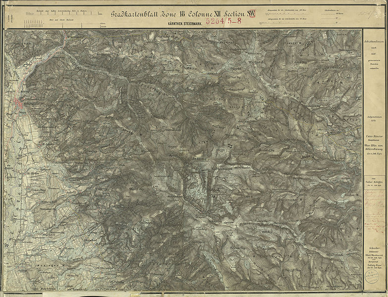
| Description | historische Landkarte: Gradkartenblatt Zone 18 Colonne XII Section SW (später 5254/3). Gebiet Koralmgipfel, Wolfsberg, Handalm, Glashütten. Franzisco-josephinische (3.) Landesaufnahme der österreichisch-ungarischen Monarchie. Aufnahmeblatt 1:25.000. Aufgenommen 1877/78 |
| Date | 1877/78 mit einzelnen Nachträgen |
| Source | Archiv des Militärgeographischen Institutes |
| Author | Österreichisch-Ungarische Monarchie, Militärgeographisches Institut |
| Permission (Reusing this file) |
historisches amtliches Werk aus dem 19. Jahrhundert, freies Werk |
Licensing
edit
|
This work is in the public domain in its country of origin and other countries and areas where the copyright term is the author's life plus 70 years or fewer.
| |
| This file has been identified as being free of known restrictions under copyright law, including all related and neighboring rights. | |
File history
Click on a date/time to view the file as it appeared at that time.
| Date/Time | Thumbnail | Dimensions | User | Comment | |
|---|---|---|---|---|---|
| current | 22:23, 21 January 2010 | | 9,659 × 7,398 (28.93 MB) | Josef Moser (talk | contribs) | schärfer |
| 19:50, 18 March 2009 |  | 9,616 × 7,367 (30.81 MB) | Josef Moser (talk | contribs) | == Beschreibung == {{Information |Description=historische Landkarte: Gradkartenblatt Zone 18 Colonne XII Section SW (später 5254/3). Gebiet Koralmgipfel, Wolfsberg, Handalm, Glashütten. Franzisco-josephinische (3.) Landesaufnahme der österreichisch-ung |
You cannot overwrite this file.
File usage on Commons
The following page uses this file:
File usage on other wikis
The following other wikis use this file:
- Usage on de.wikipedia.org