File:Aurillac (Arrondissement) Plan.svg

Size of this PNG preview of this SVG file: 543 × 508 pixels. Other resolutions: 257 × 240 pixels | 513 × 480 pixels | 821 × 768 pixels | 1,095 × 1,024 pixels | 2,189 × 2,048 pixels.
Original file (SVG file, nominally 543 × 508 pixels, file size: 63 KB)
Captions
Captions
Add a one-line explanation of what this file represents
Summary edit
_Plan.svg&action=edit§ion=1)
| Description |
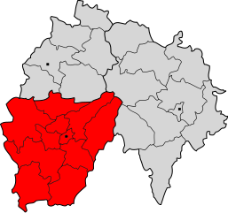
Deutsch: Lageplan des Arrondissements von Aurillac im Département Cantal. |
| Date | |
| Source | Own work (Original text: Eigene Arbeit unter Verwendung von Informationen der folgenden Internetseiten: [1] und [2]) |
| Author | Pierre Audité |
Licensing edit
_Plan.svg&action=edit§ion=2)
This file is licensed under the Creative Commons Attribution-Share Alike 2.0 Germany license.
Attribution: Pierre Audité
- You are free:
- to share – to copy, distribute and transmit the work
- to remix – to adapt the work
- Under the following conditions:
- attribution – You must give appropriate credit, provide a link to the license, and indicate if changes were made. You may do so in any reasonable manner, but not in any way that suggests the licensor endorses you or your use.
- share alike – If you remix, transform, or build upon the material, you must distribute your contributions under the same or compatible license as the original.

Original upload log edit
_Plan.svg&action=edit§ion=3)
The original description page was here. All following user names refer to de.wikipedia.
- 2007-07-06 21:17 Pierre Audité 543×508× (64164 bytes) {{Information |Beschreibung = Lageplan des Arrondissements von Aurillac im Département Cantal. |Quelle = Eigene Arbeit unter Verwendung von Informationen der folgenden Internetseiten: [http://www.insee.fr] und [http://splaf.free.fr/] |Urheber = [[Benutze
File history
Click on a date/time to view the file as it appeared at that time.
| Date/Time | Thumbnail | Dimensions | User | Comment | |
|---|---|---|---|---|---|
| current | 20:24, 17 May 2012 | | 543 × 508 (63 KB) | File Upload Bot (Magnus Manske) (talk | contribs) | Transfered from de.wikipedia by User:JuTa using CommonsHelper |
You cannot overwrite this file.
File usage on Commons
There are no pages that use this file.
File usage on other wikis
The following other wikis use this file:
- Usage on oc.wikipedia.org
_Plan.svg&oldid=807571150)