File:Austria Carinthia location map.svg

Size of this PNG preview of this SVG file: 800 × 472 pixels. Other resolutions: 320 × 189 pixels | 640 × 378 pixels | 1,024 × 604 pixels | 1,280 × 755 pixels | 2,560 × 1,511 pixels | 1,342 × 792 pixels.
Original file (SVG file, nominally 1,342 × 792 pixels, file size: 932 KB)
Captions
Captions
Add a one-line explanation of what this file represents
Summary edit
| Description |
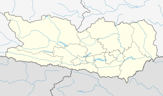
Deutsch: Positionskarte von Kärnten.
Quadratische Plattkarte. Geographische Begrenzung der Karte:
English: Location map of Carinthia.
Equirectangular projection. Geographic limits of the map:
|
| Date | |
| Source |
Own work, based on maps-for-free.com and File:Gemeinden Kärnten.svg This W3C-unspecified vector image was created with Inkscape . |
| Author | Rosso Robot, versions later 2013-10: NordNordWest |
| Other versions |
|

Licensing edit
I, the copyright holder of this work, hereby publish it under the following licenses:
This file is licensed under the Creative Commons Attribution-Share Alike 3.0 Unported license.
- You are free:
- to share – to copy, distribute and transmit the work
- to remix – to adapt the work
- Under the following conditions:
- attribution – You must give appropriate credit, provide a link to the license, and indicate if changes were made. You may do so in any reasonable manner, but not in any way that suggests the licensor endorses you or your use.
- share alike – If you remix, transform, or build upon the material, you must distribute your contributions under the same or compatible license as the original.

|
Permission is granted to copy, distribute and/or modify this document under the terms of the GNU Free Documentation License, Version 1.2 or any later version published by the Free Software Foundation; with no Invariant Sections, no Front-Cover Texts, and no Back-Cover Texts. A copy of the license is included in the section entitled GNU Free Documentation License. |
You may select the license of your choice.
File history
Click on a date/time to view the file as it appeared at that time.
| Date/Time | Thumbnail | Dimensions | User | Comment | |
|---|---|---|---|---|---|
| current | 17:31, 6 October 2013 | | 1,342 × 792 (932 KB) | NordNordWest (talk | contribs) | corr |
| 16:55, 6 October 2013 |  | 1,342 × 792 (926 KB) | NordNordWest (talk | contribs) | projection corrected | |
| 11:53, 27 May 2009 |  | 848 × 389 (59 KB) | Rosso Robot (talk | contribs) | colour correction | |
| 20:42, 26 May 2009 |  | 848 × 389 (58 KB) | Rosso Robot (talk | contribs) | drau correction | |
| 18:44, 26 May 2009 |  | 848 × 389 (58 KB) | Rosso Robot (talk | contribs) | Reverted to version as of 18:38, 26 May 2009 | |
| 18:40, 26 May 2009 |  | 848 × 389 (58 KB) | Rosso Robot (talk | contribs) | plain svg | |
| 18:38, 26 May 2009 |  | 848 × 389 (58 KB) | Rosso Robot (talk | contribs) | {{Information |Description={{de|1=Positionskarte von Kärnten}} Quadratische Plattkarte. Geographische Begrenzung der Karte: * N: 47.13836° N * S: 46.36446° N * W: 12.62604° O * O: 15.08457° O}} {{en|1=Location map of [[:en |
You cannot overwrite this file.
File usage on Commons
The following 3 pages use this file:
File usage on other wikis
The following other wikis use this file:
- Usage on ba.wikipedia.org
- Usage on bg.wikipedia.org
- Usage on cs.wikipedia.org
- Usage on cv.wikipedia.org
- Usage on de.wikipedia.org
- Hemmaberg
- Flughafen Klagenfurt
- Talübergang Lavant
- City-Arkaden Klagenfurt
- Eissportzentrum Klagenfurt
- Atrio
- Stadthalle Villach
- Mölltaler Gletscher
- ASK-Sportanlage Fischl
- Wörthersee Stadion
- Wikipedia:Kartenwerkstatt/Positionskarten/Europa
- Diskussion:Penk (Gemeinde Reißeck)
- Falkensteinbrücke
- Pfaffenbergbrücke
- Vorlage:Positionskarte Österreich Kärnten
- Klinikum Klagenfurt am Wörthersee
- Kärntner Eishockey-Derby
- Stadtpark Center Spittal
- Südpark (Einkaufszentrum)
- Affenberg Landskron
- Unfallkrankenhaus Klagenfurt
- Österreichische Fußballmeisterschaft 2012/13
- Skigebiet Großglockner Heiligenblut
- Lavanttal-Arena
- Österreichische Fußballmeisterschaft 2013/14
View more global usage of this file.