File:Austria the Tyrol location map.svg

Size of this PNG preview of this SVG file: 795 × 452 pixels. Other resolutions: 320 × 182 pixels | 640 × 364 pixels | 1,024 × 582 pixels | 1,280 × 728 pixels | 2,560 × 1,455 pixels.
Original file (SVG file, nominally 795 × 452 pixels, file size: 30 KB)
Captions
Captions
Add a one-line explanation of what this file represents
Summary edit
| Description |
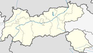
Deutsch: Positionskarte von Tirol
Quadratische Plattkarte. Geographische Begrenzung der Karte:
English: Location map of The Tyrol
Equirectangular projection. Geographic limits of the map:
|
| Date | |
| Source |
Own work, based on maps-for-free.com and File:Gemeinden Tirol.svg This W3C-unspecified vector image was created with Inkscape . |
| Author | Rosso Robot |
Licensing edit
I, the copyright holder of this work, hereby publish it under the following licenses:
This file is licensed under the Creative Commons Attribution-Share Alike 3.0 Unported license.
- You are free:
- to share – to copy, distribute and transmit the work
- to remix – to adapt the work
- Under the following conditions:
- attribution – You must give appropriate credit, provide a link to the license, and indicate if changes were made. You may do so in any reasonable manner, but not in any way that suggests the licensor endorses you or your use.
- share alike – If you remix, transform, or build upon the material, you must distribute your contributions under the same or compatible license as the original.

|
Permission is granted to copy, distribute and/or modify this document under the terms of the GNU Free Documentation License, Version 1.2 or any later version published by the Free Software Foundation; with no Invariant Sections, no Front-Cover Texts, and no Back-Cover Texts. A copy of the license is included in the section entitled GNU Free Documentation License. |
You may select the license of your choice.
File history
Click on a date/time to view the file as it appeared at that time.
| Date/Time | Thumbnail | Dimensions | User | Comment | |
|---|---|---|---|---|---|
| current | 06:38, 28 May 2009 | | 795 × 452 (30 KB) | Rosso Robot (talk | contribs) | border add. |
| 14:09, 27 May 2009 |  | 795 × 452 (29 KB) | Rosso Robot (talk | contribs) | {{Information |Description={{de|1=Positionskarte von Tirol}} Quadratische Plattkarte. Geographische Begrenzung der Karte: * N: 47.75317° N * S: 46.64119° N * W: 10.08236° O * O: 12.98961° O}} Location map of [[:en:The Tyrol|Th |
You cannot overwrite this file.
File usage on Commons
The following 2 pages use this file:
File usage on other wikis
The following other wikis use this file:
- Usage on ba.wikipedia.org
- Usage on cs.wikipedia.org
- Usage on hr.wikipedia.org
- Usage on kbd.wikipedia.org
- Usage on lv.wikipedia.org
- Usage on pl.wikipedia.org
- Innsbruck
- Brenner
- Hochfilzen
- Alpbach (gmina)
- Bergisel
- Hochfrottspitze
- Dreitorspitze
- Mädelegabel
- Bockkarkopf
- Biberkopf
- Hochvogel
- Serfaus
- Pfitscher Joch
- Hall in Tirol
- Port lotniczy Innsbruck
- Hochfeiler
- Kitzbühel
- Kufstein
- Jenbach (Austria)
- Matrei in Osttirol
- Innsbruck Hauptbahnhof
- Birnlücke
- Tivoli Neu
- Imst
- Landeck (Austria)
- Lienz
- Schwaz
- Europabrücke
- Seefeld in Tirol
- Telfs
- Wörgl
- Sölden (Tyrol)
View more global usage of this file.