File:Autovías Murcia.png
Size of this preview: 800 × 566 pixels. Other resolutions: 320 × 226 pixels | 640 × 452 pixels | 1,024 × 724 pixels | 1,280 × 905 pixels | 2,338 × 1,653 pixels.
Original file (2,338 × 1,653 pixels, file size: 1.39 MB, MIME type: image/png)
Captions
Captions
Add a one-line explanation of what this file represents
Summary
edit
| Description |
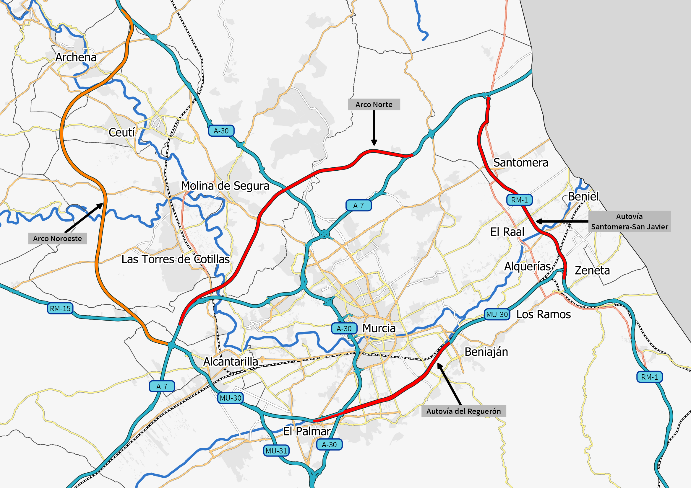
Español: Mapa de las autovías en el entorno de Murcia, con los futuros Arcos Norte y Noroeste, Autovía del Reguerón y RM-1.
Autovías en servicio Autovías en proyecto Autovías en construcción |
| Date | |
| Source | Own work |
| Author | Dsaneus |
Licensing
edit
I, the copyright holder of this work, hereby publish it under the following license:
This file is licensed under the Creative Commons Attribution-Share Alike 4.0 International license.
- You are free:
- to share – to copy, distribute and transmit the work
- to remix – to adapt the work
- Under the following conditions:
- attribution – You must give appropriate credit, provide a link to the license, and indicate if changes were made. You may do so in any reasonable manner, but not in any way that suggests the licensor endorses you or your use.
- share alike – If you remix, transform, or build upon the material, you must distribute your contributions under the same or compatible license as the original.
File history
Click on a date/time to view the file as it appeared at that time.
| Date/Time | Thumbnail | Dimensions | User | Comment | |
|---|---|---|---|---|---|
| current | 09:39, 9 September 2021 | | 2,338 × 1,653 (1.39 MB) | Dsaneus (talk | contribs) | Apertura Autovía del Reguerón |
| 12:30, 10 December 2019 |  | 2,338 × 1,653 (1.49 MB) | Dsaneus (talk | contribs) | Cambio colores y texto | |
| 20:29, 17 October 2019 |  | 2,338 × 1,653 (1.5 MB) | Dsaneus (talk | contribs) | Actualizado Arco Noroeste en construcción. | |
| 09:52, 21 September 2019 |  | 2,338 × 1,653 (1.5 MB) | Dsaneus (talk | contribs) | Nueva versión del mapa con más información y detalle. | |
| 16:59, 17 November 2018 |  | 1,239 × 944 (307 KB) | Dsaneus (talk | contribs) | User created page with UploadWizard |
You cannot overwrite this file.
File usage on Commons
The following 14 pages use this file:
- User:Chumwa/OgreBot/Potential transport maps/2018 November 11-20
- User:Chumwa/OgreBot/Potential transport maps/2019 December 1-10
- User:Chumwa/OgreBot/Potential transport maps/2019 October 11-20
- User:Chumwa/OgreBot/Potential transport maps/2019 September 21-30
- User:Chumwa/OgreBot/Transport Maps/2018 November 11-20
- User:Chumwa/OgreBot/Transport Maps/2019 December 1-10
- User:Chumwa/OgreBot/Transport Maps/2019 October 11-20
- User:Chumwa/OgreBot/Transport Maps/2019 September 21-30
- User:Chumwa/OgreBot/Transport Maps/2021 September 1-10
- User:Chumwa/OgreBot/Travel and communication maps/2018 November 11-20
- User:Chumwa/OgreBot/Travel and communication maps/2019 December 1-10
- User:Chumwa/OgreBot/Travel and communication maps/2019 October 11-20
- User:Chumwa/OgreBot/Travel and communication maps/2019 September 21-30
- User:Chumwa/OgreBot/Travel and communication maps/2021 September 1-10
File usage on other wikis
The following other wikis use this file:
- Usage on es.wikipedia.org