File:BHPward2-Woodingdean.svg

Size of this PNG preview of this SVG file: 800 × 533 pixels. Other resolutions: 320 × 213 pixels | 640 × 427 pixels | 1,024 × 683 pixels | 1,280 × 853 pixels | 2,560 × 1,707 pixels | 2,100 × 1,400 pixels.
Original file (SVG file, nominally 2,100 × 1,400 pixels, file size: 5.75 MB)
Captions
Captions
Add a one-line explanation of what this file represents
Summary edit
| Description |
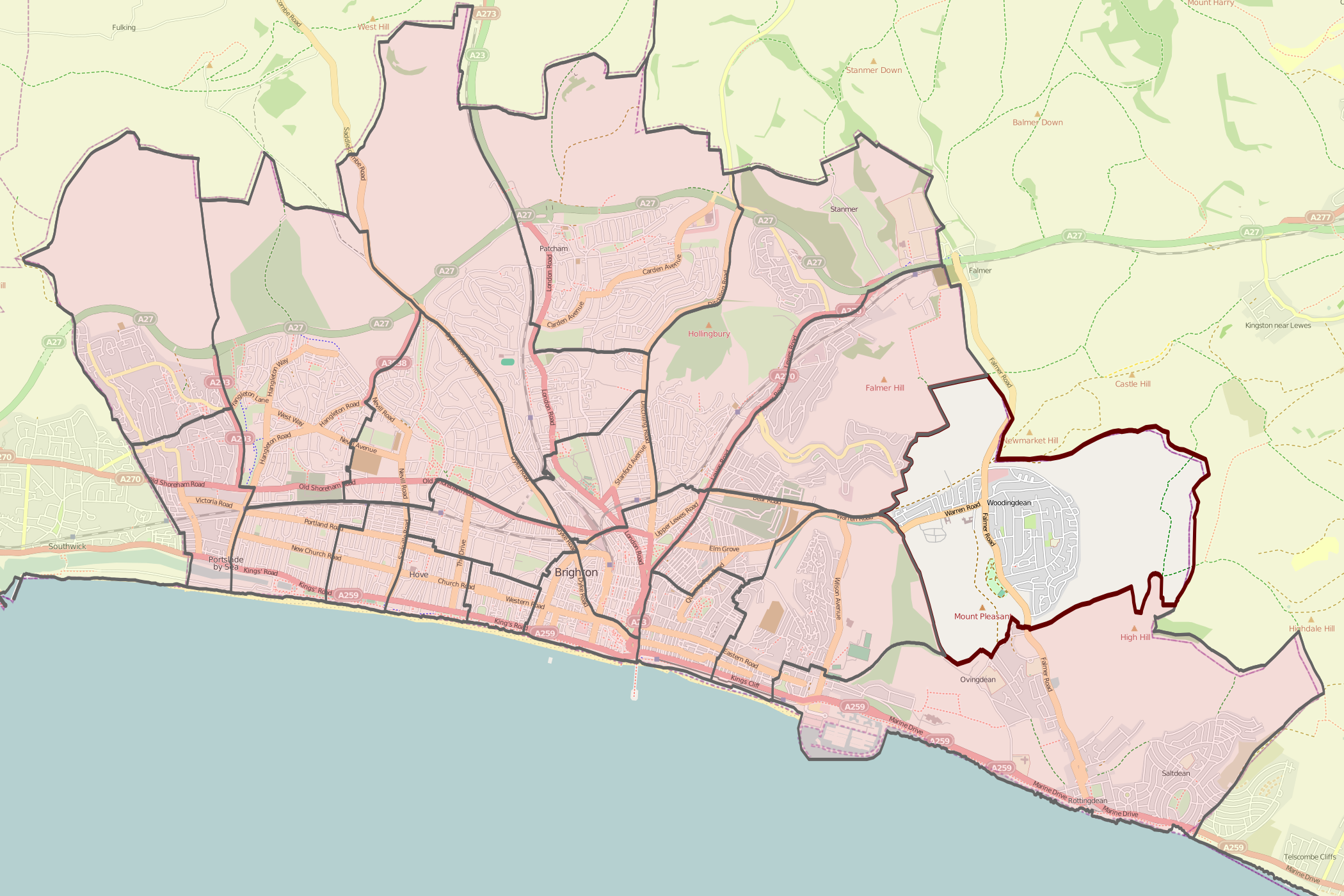
English: Map of Brighton and Hove wards with one ward highlighted |
| Source | Background from http://www.openstreetmap.org/ ; ward data Ordnance Survey OpenData from Boundary-Line product |
| Author | Downloaded by Sussexonian from OpenStreetMap data; Ward boundary data by Nilfanion, created using Ordnance Survey data |
| Permission (Reusing this file) |
This file is licensed under the Creative Commons Attribution-Share Alike 2.0 Generic license. Attribution: OpenStreetMap: contains Ordnance Survey data © Crown copyright and database right 2010.
|
| SVG development |
Licensing edit
I, the copyright holder of this work, hereby publish it under the following license:
This file is licensed under the Creative Commons Attribution-Share Alike 3.0 Unported license.
- You are free:
- to share – to copy, distribute and transmit the work
- to remix – to adapt the work
- Under the following conditions:
- attribution – You must give appropriate credit, provide a link to the license, and indicate if changes were made. You may do so in any reasonable manner, but not in any way that suggests the licensor endorses you or your use.
- share alike – If you remix, transform, or build upon the material, you must distribute your contributions under the same or compatible license as the original.
File history
Click on a date/time to view the file as it appeared at that time.
| Date/Time | Thumbnail | Dimensions | User | Comment | |
|---|---|---|---|---|---|
| current | 10:54, 14 May 2011 | | 2,100 × 1,400 (5.75 MB) | Sussexonian (talk | contribs) | {{Information |Description ={{en|1=Map of Brighton and Hove wards with one ward highlighted}} |Source =Background from http://www.openstreetmap.org/ ; ward data Ordnance Survey [https://www.ordnancesurvey.co.uk/opendatadownload/products.html Op |
You cannot overwrite this file.
File usage on Commons
The following page uses this file: