File:BadSalzuflen TrasseB 2008-05-24 P7121.JPG

Size of this preview: 800 × 527 pixels. Other resolutions: 320 × 211 pixels | 640 × 422 pixels | 1,024 × 674 pixels | 1,280 × 843 pixels | 2,496 × 1,644 pixels.
Original file (2,496 × 1,644 pixels, file size: 1.16 MB, MIME type: image/jpeg)
Captions
Captions
Add a one-line explanation of what this file represents
Summary
edit
| Camera location | | View this and other nearby images on: OpenStreetMap |
|---|
| Description |
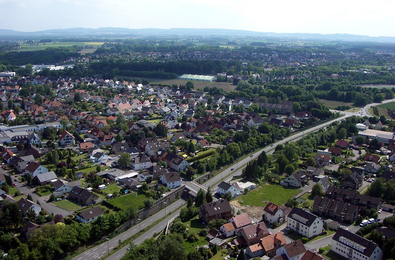
Deutsch: Dies Luftbild wurde mit Hilfe eines Drachens aufgenommen, der die Kamera in eine Höhe von ca. 100 Meter gezogen hat.
Startplatz war am Kreuzweg. Man sieht die Lockhauser Straße (L535), die zur Umgehungsstraße 'Am Zubringer' (B239) führt. Über die Brücke führt die Straße 'Lohheide'. Am Horizont erkennt man den Teutoburger Wald. |
| Date | |
| Source | Own work |
| Author | WwwFrank |
auch veröffentlicht auf www.fotodrachen.de
Licensing
edit
I, the copyright holder of this work, hereby publish it under the following license:
This file is licensed under the Creative Commons Attribution-Share Alike 3.0 Unported license.
- You are free:
- to share – to copy, distribute and transmit the work
- to remix – to adapt the work
- Under the following conditions:
- attribution – You must give appropriate credit, provide a link to the license, and indicate if changes were made. You may do so in any reasonable manner, but not in any way that suggests the licensor endorses you or your use.
- share alike – If you remix, transform, or build upon the material, you must distribute your contributions under the same or compatible license as the original.
File history
Click on a date/time to view the file as it appeared at that time.
| Date/Time | Thumbnail | Dimensions | User | Comment | |
|---|---|---|---|---|---|
| current | 17:27, 27 December 2011 | | 2,496 × 1,644 (1.16 MB) | WwwFrank (talk | contribs) |
You cannot overwrite this file.
File usage on Commons
The following 2 pages use this file:
File usage on other wikis
The following other wikis use this file:
- Usage on de.wikipedia.org
- Usage on fi.wikipedia.org