File:Badajoz-loc.svg

Size of this PNG preview of this SVG file: 512 × 386 pixels. Other resolutions: 319 × 240 pixels | 637 × 480 pixels | 1,019 × 768 pixels | 1,280 × 965 pixels | 2,560 × 1,930 pixels.
Original file (SVG file, nominally 512 × 386 pixels, file size: 373 KB)
Captions
Captions
Add a one-line explanation of what this file represents
Summary edit
| Description |
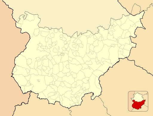
English: Location map of Province of Badajoz
Equirectangular projection, N/S stretching 130 %. Geographic limits of the map:
Español: Mapa de localización de la Provincia de Badajoz
Proyección equirrectangular (cilíndrica equidistante), N/S estirada 130 %. Límites geográficos del mapa:
|
|
| Date | ||
| Source | Own work based on: EspañaLoc.svg by HansenBCN | |
| Author | Miguillen | |
| SVG development |
|
Licensing edit
Miguillen, the copyright holder of this work, hereby publishes it under the following license:
This file is licensed under the Creative Commons Attribution-Share Alike 3.0 Unported license.
Attribution: Miguillen
- You are free:
- to share – to copy, distribute and transmit the work
- to remix – to adapt the work
- Under the following conditions:
- attribution – You must give appropriate credit, provide a link to the license, and indicate if changes were made. You may do so in any reasonable manner, but not in any way that suggests the licensor endorses you or your use.
- share alike – If you remix, transform, or build upon the material, you must distribute your contributions under the same or compatible license as the original.
| Annotations | This image is annotated: View the annotations at Commons |
File history
Click on a date/time to view the file as it appeared at that time.
| Date/Time | Thumbnail | Dimensions | User | Comment | |
|---|---|---|---|---|---|
| current | 15:48, 10 December 2010 | | 512 × 386 (373 KB) | Miguillen (talk | contribs) | id |
| 15:46, 10 December 2010 |  | 512 × 386 (390 KB) | Miguillen (talk | contribs) | colores y amplio escala para que respire un poco | |
| 10:00, 17 November 2010 |  | 512 × 386 (282 KB) | Miguillen (talk | contribs) | == {{int:filedesc}} == {{Information |Description={{en|Location map of Province of Badajoz}} Equirectangular projection, N/S stretching 130 %. Geographic limits of the map: * N: ° N * S: ° N * W: ° O * E: ° O {{es|M |
You cannot overwrite this file.
File usage on Commons
There are no pages that use this file.
File usage on other wikis
The following other wikis use this file:
- Usage on ba.wikipedia.org
- Usage on eo.wikipedia.org
- Usage on es.wikipedia.org
- Azuaga
- Monterrubio de la Serena
- Casas de Reina
- Llerena
- Medellín (España)
- Zafra
- Badajoz
- Almendralejo
- Ahillones
- Jerez de los Caballeros
- Olivenza
- Alburquerque
- Talarrubias
- Villanueva de la Serena
- Fuente de Cantos
- La Parra (Badajoz)
- Burguillos del Cerro
- Segura de León
- Fuente del Arco
- San Vicente de Alcántara
- Acedera (Badajoz)
- Alconera
- Bienvenida (Badajoz)
- Villarta de los Montes
- Puebla de Alcocer
- Alange
- Usagre
- Cancho Roano
- Zalamea de la Serena
- Torre de Miguel Sesmero
- Malcocinado
- Garlitos
- Fregenal de la Sierra
- Oliva de Mérida
- Hornachos
- Aeropuerto de Badajoz
- Castilblanco
- Peraleda del Zaucejo
- Campanario (Badajoz)
- Ribera del Fresno
- Higuera de la Serena
- Guareña (Badajoz)
- Don Benito
View more global usage of this file.